Showing posts with label MIKE URBAN. Show all posts
Showing posts with label MIKE URBAN. Show all posts
Friday, 19 December 2014
MIKE URBAN IS NOW FREE FOR UK WATER COMPANIES!
We are pleased to announce that, for UK-based Water Companies, MIKE URBAN is now available with no initial investment cost, when signing up to a minimum three year Support and Maintenance (SMA) agreement.
The deal includes:
This deal would allow you to complement your existing 1D-2D toolset with the power and flexibility of MIKE URBAN.
The MIKE by DHI (Urban) suite of fully integrated software tools offers many advantages over 1D pipe models and standard integrated catchment models:
The following Thematic, Urban Drainage / Flooding training courses are planned for 2015:
RECENT EVENTS
We participated in the 30th Anniversary of the CIWEM Urban Drainage Group Autumn Conference (2014). The presentations delivered at the conference illustrate the many benefits of MIKE URBAN:
For more information on the MIKE URBAN offer above, please contact Steve Flood on mikebydhi.uk@dhigroup.com or 02380 381961
Not a UK Water Company? Please call to discuss model features, licensing options and pricing.
We are pleased to announce that, for UK-based Water Companies, MIKE URBAN is now available with no initial investment cost, when signing up to a minimum three year Support and Maintenance (SMA) agreement.
The deal includes:
- MIKE URBAN Model Manager (including EPANET and SWMM5)
- CS-Pipeflow 1D Pipe flow modelling (MOUSE and MIKE 1D Engine)
- CS-RR Rainfall-runoff models
- CS-Control* Advanced real-time control capabilities
- CS-CA* Catchment analysis tools
- CS-PT* Advection-dispersion and sediment transport modelling
- CS-BP* Chemical and biological processes in sanitary and combined systems
- MIKE FLOOD 2D Overland* for combined 1D Pipe-flow and 2D Overland flow simulations
- MIKE 21 AD* 2D (and 1D-2D) advection-dispersion modelling
This deal would allow you to complement your existing 1D-2D toolset with the power and flexibility of MIKE URBAN.
The MIKE by DHI (Urban) suite of fully integrated software tools offers many advantages over 1D pipe models and standard integrated catchment models:
- True long term / continuous simulations rather than event based hydrology - slow response runoff modelling using rainfall dependent infiltration (RDI) to accurately model seasonal variations in infiltration and pipe flow.
- Advanced water quality simulations - fully integrated 1D-2D advection-dispersion modelling in order to consider the transport of polluted flood waters.
- Two-way interaction between pipes in the ground and the surrounding aquifer (groundwater) - modelling of infiltration to and leakage from pipes.
- Analysis of sulphide gas formation - assessment of odour and corrosion of infrastructure.
- Globally applicable rainfall-runoff models (including fully distributed hydrology).
- Local area weather radar integration (up to 100m spatial resolution).
- Online, web-based forecasting and warning tools with computer aided real-time control of pumps and storage features.
- Speed up simulations using a unique combined CPU-GPU approach.
- Seamless integration of powerful river, overland flow and marine models.
- COMING SOON: Catchment and site scale water quality treatment processes in sustainable drainage features (SuDS)
The following Thematic, Urban Drainage / Flooding training courses are planned for 2015:
- Screening of Urban Flood Risk - Cost-effective mapping of urban flood risk
- Modelling of Storm Water for Green Cities
- FREE TRAINING: Flood Waters Are Not Blue - Upgrade your flood models to consider the impacts of sediments and the transport of polluted flood waters (1-day 'Beyond Hydrodynamics' seminar)
RECENT EVENTS
We participated in the 30th Anniversary of the CIWEM Urban Drainage Group Autumn Conference (2014). The presentations delivered at the conference illustrate the many benefits of MIKE URBAN:
- Ten Years of Coupled Hydrology and Hydraulic Modelling Supporting Storm Water Management: Some examples, lessons learnt and a look forward - http://www.slideshare.net/sjf_dhi/10-years-coupled-flood-modelling
- Slow Response Runoff Modelling and ‘Real Time’ Simulations: A Swedish perspective - http://www.slideshare.net/sjf_dhi/2014-udg-conference-presentation
- 2014 UDG Delegate Pack Flyer - http://www.slideshare.net/sjf_dhi/udg-mike-by-dhi-delegate-pack-november-2014-v4
For more information on the MIKE URBAN offer above, please contact Steve Flood on mikebydhi.uk@dhigroup.com or 02380 381961
Not a UK Water Company? Please call to discuss model features, licensing options and pricing.
Offer valid in mainland United Kingdom only - other terms and conditions may apply. We reserve the right to amend or withdraw this offer at any time.
Monday, 15 December 2014
MIKE URBAN IS NOW FREE FOR UK WATER COMPANIES!
We are pleased to announce that, for UK-based Water Companies, MIKE URBAN is now available with no initial investment cost, when signing up to a minimum three year Support and Maintenance (SMA) agreement.
The deal includes:
This deal would allow you to complement your existing 1D-2D toolset with the power and flexibility of MIKE URBAN.
The MIKE by DHI (Urban) suite of fully integrated software tools offers many advantages over 1D pipe models and standard integrated catchment models:
The following Thematic, Urban Drainage Training Courses are planned for 2015:
RECENT EVENTS
We participated in the 30th Anniversary of the CIWEM Urban Drainage Group Autumn Conference (2014). The presentations delivered at the conference illustrate the many benefits of MIKE URBAN:
For more information on the MIKE URBAN offer above, please contact Steve Flood on mikebydhi.uk@dhigroup.com or 02380 381961
Not a UK Water Company? Please call to discuss model features, licensing options and pricing.
We are pleased to announce that, for UK-based Water Companies, MIKE URBAN is now available with no initial investment cost, when signing up to a minimum three year Support and Maintenance (SMA) agreement.
The deal includes:
- MIKE URBAN Model Manager (including EPANET and SWMM5)
- CS-Pipeflow 1D Pipe flow modelling (MOUSE and MIKE 1D Engine)
- CS-RR Rainfall-runoff models
- CS-Control* Advanced real-time control capabilities
- CS-CA* Catchment analysis tools
- CS-PT* Advection-dispersion and sediment transport modelling
- CS-BP* Chemical and biological processes in sanitary and combined systems
- MIKE FLOOD 2D Overland* for combined 1D Pipe-flow and 2D Overland flow simulations
- MIKE 21 AD* 2D (and 1D-2D) advection-dispersion modelling
This deal would allow you to complement your existing 1D-2D toolset with the power and flexibility of MIKE URBAN.
The MIKE by DHI (Urban) suite of fully integrated software tools offers many advantages over 1D pipe models and standard integrated catchment models:
- True long term / continuous simulations rather than event based hydrology - slow response runoff modelling using rainfall dependent infiltration (RDI) to accurately model seasonal variations in infiltration and pipe flow.
- Advanced water quality simulations - fully integrated 1D-2D advection-dispersion modelling in order to consider the transport of polluted flood waters.
- Two-way interaction between pipes in the ground and the surrounding aquifer (groundwater) - modelling of infiltration to and leakage from pipes.
- Analysis of sulphide gas formation - assessment of odour and corrosion of infrastructure.
- Globally applicable rainfall-runoff models (including fully distributed hydrology).
- Local area weather radar integration (up to 100m spatial resolution).
- Online, web-based forecasting and warning tools with computer aided real-time control of pumps and storage features.
- Speed up simulations using a unique combined CPU-GPU approach.
- Seamless integration of powerful river, overland flow and marine models.
- COMING SOON: Catchment and site scale water quality treatment processes in sustainable drainage features (SuDS)
The following Thematic, Urban Drainage Training Courses are planned for 2015:
- Screening of Urban Flood Risk: Cost-effective mapping of urban flood risk
- Modelling of Storm Water for Green Cities
RECENT EVENTS
We participated in the 30th Anniversary of the CIWEM Urban Drainage Group Autumn Conference (2014). The presentations delivered at the conference illustrate the many benefits of MIKE URBAN:
- Ten Years of Coupled Hydrology and Hydraulic Modelling Supporting Storm Water Management: Some examples, lessons learnt and a look forward - http://www.slideshare.net/sjf_dhi/10-years-coupled-flood-modelling
- Slow Response Runoff Modelling and ‘Real Time’ Simulations: A Swedish perspective - http://www.slideshare.net/sjf_dhi/2014-udg-conference-presentation
- 2014 UDG Delegate Pack Flyer - http://www.slideshare.net/sjf_dhi/udg-mike-by-dhi-delegate-pack-november-2014-v4
For more information on the MIKE URBAN offer above, please contact Steve Flood on mikebydhi.uk@dhigroup.com or 02380 381961
Not a UK Water Company? Please call to discuss model features, licensing options and pricing.
Offer valid in mainland United Kingdom only - other terms and conditions may apply. We reserve the right to amend or withdraw this offer at any time.
Slow Response Runoff Modelling and ‘Real Time’ simulations
Slow Response Runoff Modelling and ‘Real Time’ simulations: A Swedish perspective - Andy Wilson, DHI Sweden

Delivered at: -
CIWEM
Urban Drainage Group 30th Anniversary Autumn Conference
11 Nov 14 - 13 Nov 14
Hilton Hotel, Blackpool, UK
Slow Response Runoff Modelling and ‘Real Time’ simulations: A Swedish perspective - Andy Wilson, DHI Sweden
Delivered at: -
CIWEM
Urban Drainage Group 30th Anniversary Autumn Conference
11 Nov 14 - 13 Nov 14
Hilton Hotel, Blackpool, UK
Ten Years of Coupled Hydrology and Hydraulic Modelling Supporting Storm Water Management
Ten Years of Coupled Hydrology and Hydraulic Modelling Supporting Storm Water Management: Some examples, lessons learnt and a look forward - Ole Larsen, APAC Research Director, DHI Singapore

Delivered at: -
CIWEM
Urban Drainage Group 30th Anniversary Autumn Conference
11 Nov 14 - 13 Nov 14
Hilton Hotel, Blackpool, UK
Ten Years of Coupled Hydrology and Hydraulic Modelling Supporting Storm Water Management from sjf_dhi
Ten Years of Coupled Hydrology and Hydraulic Modelling Supporting Storm Water Management: Some examples, lessons learnt and a look forward - Ole Larsen, APAC Research Director, DHI Singapore
Delivered at: -
CIWEM
Urban Drainage Group 30th Anniversary Autumn Conference
11 Nov 14 - 13 Nov 14
Hilton Hotel, Blackpool, UK
Monday, 2 December 2013
Previews of MIKE by DHI Release 2014
Approximately once a year, we release a new version of our MIKE by DHI software - and this year is no exception. We would like to reveal herewith a preview of some of the new and exciting features to be released in December. We hope these new features will improve your experience with our software products, regarding usability, productivity as well as enhanced applications.
New possibilities of including moving objects in your animations
Ever wanted to add moving objects to your animations? This is possible with Release 2014.
In the September issue of this newsletter, we included a preview of new features in MIKE Animator Plus in Release 2014. In this issue, we would like to show you an example of the possibilities of this new development.
With MIKE Animator Plus, you can create visual animations to present you model results – and as something new, you will be able to include visualisation of solids. Through the inclusion of solids, you can improve your animations significantly by enhancing realism and recognition of locations, for example by including fixed elements like buildings and dams or moving elements like ships. Release 2014 will support the placement of solids inside the model domain and allow them to move, which means that a ship can be sailing as part of the animation.
MIKE HYDRO Basin: Global prioritisation of water users
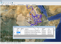 MIKE HYDRO Basin is our new generation of integrated river basin analysis software for water resources planning and management.
MIKE HYDRO Basin was introduced with the current release 2012, containing a large number of features relevant for integrated river basin management applications. Developments continue for MIKE HYDRO Basin and the new release will introduce another very interesting new feature to modellers of river basin water allocation schemes and resources management; Global Prioritisation.
With this new feature, it is now possible to include a user defined prioritisation of water users within the basin model - regardless of their geographical location within the basin. Thus, it highly increases the applicability of MIKE HYDRO Basin for specific types of water resources management applications.
The global prioritisation of water users are defined through ‘Ranking’ number definitions, where water consumers are assigned an individual ranking number. The ranking numbers are used during simulation to prioritise consumers, in case of water shortage, in order to accommodate the water demands for these - taking into account that some users have a higher priority than others.
Mesh Generation: A new tool for creating flexible meshes from dfs2 files and other sources
 The combination of high flexibility of flexible meshes (FM) and impressive performance improvements, introduced in the latest releases of MIKE by DHI, make the use of FM versions of MIKE 21, MIKE 3 and MIKE FLOOD even more attractive. Improvements in recent releases include, amongst others, the introduction of shared memory based parallelisation, porting of simulation engines to LINUX and, in Release 2014, supporting Graphical Processing Units (GPUs) for MIKE 21 HD FM.
In order to assist those, who want to transfer existing models or bathymetries into the FM system, Release 2014 will contain a new tool, aimed to convert bathymetries in other formats into FM format.
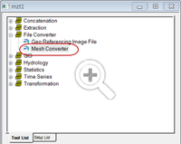
The new Mesh Converter is included in the MIKE Zero Toolbox and supports DHI’s own format from the ‘classic’ modelling series, dfs2 as well as some external formats (ADCIRC, SMS, TUFLOW). The process is quick and easy and produces an equal bathymetry in FM format, which can then be modified using all the existing editing facilities of MIKE Zero’s Mesh Generator.
New features in FEFLOW 6.2
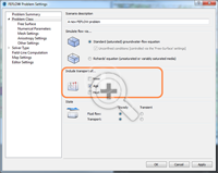 FEFLOW 6.2 offers a number of new features to enhance your groundwater modelling work.
Storage Capture/Release is a new component in the Rate Budget and Period Budget Panels for flow and transport in FEFLOW 6.2. With this new component, you can clearly separate storage change and solution error in transient models.
Increased performance with new MIKE 1D features in MIKE URBAN
Strengthening wastewater modelling projects with new features in WEST 2014
We are also pleased to inform you that Release 2014 of WEST will include a plant wide model (PWM) for simulating nutrient removal activated sludge systems.
The plant wide model is developed jointly by our WEST Development Centres, the Universities of Cape Town (UCT) and kwaZulu-Natal in South Africa.
Approximately once a year, we release a new version of our MIKE by DHI software - and this year is no exception. We would like to reveal herewith a preview of some of the new and exciting features to be released in December. We hope these new features will improve your experience with our software products, regarding usability, productivity as well as enhanced applications.
New possibilities of including moving objects in your animations
Ever wanted to add moving objects to your animations? This is possible with Release 2014.
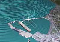 |
| Click here to view an example of the possibilities of this new feature. |
With MIKE Animator Plus, you can create visual animations to present you model results – and as something new, you will be able to include visualisation of solids. Through the inclusion of solids, you can improve your animations significantly by enhancing realism and recognition of locations, for example by including fixed elements like buildings and dams or moving elements like ships. Release 2014 will support the placement of solids inside the model domain and allow them to move, which means that a ship can be sailing as part of the animation.
MIKE HYDRO Basin: Global prioritisation of water users
MIKE HYDRO Basin was introduced with the current release 2012, containing a large number of features relevant for integrated river basin management applications. Developments continue for MIKE HYDRO Basin and the new release will introduce another very interesting new feature to modellers of river basin water allocation schemes and resources management; Global Prioritisation.
With this new feature, it is now possible to include a user defined prioritisation of water users within the basin model - regardless of their geographical location within the basin. Thus, it highly increases the applicability of MIKE HYDRO Basin for specific types of water resources management applications.
The global prioritisation of water users are defined through ‘Ranking’ number definitions, where water consumers are assigned an individual ranking number. The ranking numbers are used during simulation to prioritise consumers, in case of water shortage, in order to accommodate the water demands for these - taking into account that some users have a higher priority than others.
Mesh Generation: A new tool for creating flexible meshes from dfs2 files and other sources
In order to assist those, who want to transfer existing models or bathymetries into the FM system, Release 2014 will contain a new tool, aimed to convert bathymetries in other formats into FM format.
The new Mesh Converter is included in the MIKE Zero Toolbox and supports DHI’s own format from the ‘classic’ modelling series, dfs2 as well as some external formats (ADCIRC, SMS, TUFLOW). The process is quick and easy and produces an equal bathymetry in FM format, which can then be modified using all the existing editing facilities of MIKE Zero’s Mesh Generator.
New features in FEFLOW 6.2
Groundwater age calculation in FEFLOW 6.2
Groundwater Age is a new type of problem class, similar to mass or heat transport. With this, many questions can be easily answered, such as:
- How long is the average underground travel time of water pumped at a well?
- What‘s the percentage of bank filtration at the supply wells?
- What‘s the age and remaining travel time of groundwater at a certain location?
Storage Capture/Release is a new component in the Rate Budget and Period Budget Panels for flow and transport in FEFLOW 6.2. With this new component, you can clearly separate storage change and solution error in transient models.
Increased performance with new MIKE 1D features in MIKE URBAN
In 2012, we introduced a new generic 1D numerical engine for MIKE by DHI products. With the upcoming release of MIKE URBAN 2014, a number of new features for MIKE 1D will be available such as:
- coupling to MIKE SHE
- options for Advection-Dispersion modelling
- result presentation in MIKE URBAN
- and many more…
Strengthening wastewater modelling projects with new features in WEST 2014
Our WEST software package, for modelling wastewater treatment plants, has quickly established itself as an important product in the MIKE by DHI family with a growing number of users all over the world. Release 2014 includes several important new features, including:
- New Report Generator, which enables the user to automatically create reports containing graphs and data pertaining to a project in a variety of formats including: project information, plant layout, plots and tables.
- Integrated urban water system (IUWS) libraries, making WEST a powerful tool for identifying synergies and to globally optimise the wastewater system performance on a catchment scale.
We are also pleased to inform you that Release 2014 of WEST will include a plant wide model (PWM) for simulating nutrient removal activated sludge systems.
The plant wide model, ‘PWM_SA’, is a three phase model for the simulation of nutrient removal activated sludge systems coupled with the anaerobic (organisms independent of oxygen), aerobic (organisms dependent on oxygen) and anoxic-aerobic digestion of sewage sludge. This includes waste activated sludge produced by biological excess phosphorus removal plants. The model is based on strict material mass balance and is prepared by linking:
- a variation of ASM2 for activated sludge nitrogen and phosphorus removal and aerobic or anoxic–aerobic digestion
- a variation of the UCT anaerobic digestion model.
The plant wide model is developed jointly by our WEST Development Centres, the Universities of Cape Town (UCT) and kwaZulu-Natal in South Africa.
Thursday, 14 November 2013
 |
| Link to ICFR 2013 Website |
Experiences in Asia and Europe
5-7 September 2013
Exeter, United Kingdom
A belated thank you to the team at the University of Exeter (David Butler, Albert Chen, Slobodan Djordjević, Michael Hammond, their colleagues and students), and their CORFU partners, for the exceptional ICFR 2013 conference held in September 2013. It was great to see so many fantastic presentations of projects featuring innovative use of MIKE by DHI software (particularly MIKE URBAN and MIKE FLOOD) and new MIKE CUSTOMISED solutions.
 |
| DHI's Ole Mark speaks at ICFR 2013 |
- Flood damage assessment for urban growth scenarios - A. S. Chen (presenter), M. J. Hammond, S. Djordjević, D. Butler
- Getting started with urban flood modelling for real-time pluvial flood forecasting - Jeanne-Rose René (presenter), Slobodan Djordjević, David Butler, Henrik Madsen, Ole Mark
The University of Exeter have also developed a CORFU Flood Damage Assessment Tool (compatible with the Multi-Coloured Manual) for MIKE 21, MIKE FLOOD and MIKE URBAN results files (i.e. dfs2 and dfsu). We hope to have more information on this tool very soon.
Thursday, 1 August 2013
Local Area Weather Radar for Urban Hydrology
Climate change can be expected to affect prevailing patterns of precipitation with extreme rain events becoming more frequent and more intense. This will increase the pressure on water collection systems and wastewater treatment plants. Warning and forecasting systems provide necessary tools for authorities and operators to plan ahead and make the right decisions. Accurate predictions can be made if sufficient data are available. However, the greatest uncertainty when modelling the response of drainage systems to rainfall is the rainfall itself.
The standard approach is to use rainfall measured by one gauge but traditional rain gauges provide data with low temporal and spatial resolution. When using rain gauges, it must be assumed that the rainfall is homogenous over the whole model area, which may be as large as a whole city. For the prediction of potential surface water flooding as a result of extreme rain events, this assumption is not valid.
Weather radars, in contrast to rain gauges, provide high resolution data over a relatively large area, the equivalent of many synthetic rain gauges in one installation. However, dedicated weather radars are expensive. Local Area Weather Radar (LAWR), developed by DHI from modified marine radar and using interpretation algorithms, can provide high resolution rainfall data at a much lower cost. Such systems are already installed in many cities worldwide. They detect the first raindrop falling and track the precipitation as it falls. This provides accurate rainfall data with high spatial resolution, which is suitable for input to flood warning and forecast models.
LAWR Advantages and Integration

The image above shows a rain event imported into MIKE URBAN. It illustrates a classical problem - only part of the drainage system is receiving rain. If a user wants to analyse such an event based on a single gauge several kilometres away it would yield a very poor result. LAWR data provides the user with a whole range of new opportunities. It is possible to see the event move and evolve over the drainage system, and see which catchments receive the heavy intensities.
Climate change can be expected to affect prevailing patterns of precipitation with extreme rain events becoming more frequent and more intense. This will increase the pressure on water collection systems and wastewater treatment plants. Warning and forecasting systems provide necessary tools for authorities and operators to plan ahead and make the right decisions. Accurate predictions can be made if sufficient data are available. However, the greatest uncertainty when modelling the response of drainage systems to rainfall is the rainfall itself.
The standard approach is to use rainfall measured by one gauge but traditional rain gauges provide data with low temporal and spatial resolution. When using rain gauges, it must be assumed that the rainfall is homogenous over the whole model area, which may be as large as a whole city. For the prediction of potential surface water flooding as a result of extreme rain events, this assumption is not valid.
Weather radars, in contrast to rain gauges, provide high resolution data over a relatively large area, the equivalent of many synthetic rain gauges in one installation. However, dedicated weather radars are expensive. Local Area Weather Radar (LAWR), developed by DHI from modified marine radar and using interpretation algorithms, can provide high resolution rainfall data at a much lower cost. Such systems are already installed in many cities worldwide. They detect the first raindrop falling and track the precipitation as it falls. This provides accurate rainfall data with high spatial resolution, which is suitable for input to flood warning and forecast models.
LAWR Advantages and Integration
- Distributed rainfall measurements in a spatial resolution ranging from 500x500 m to 100x100 m with a 5 minute or 1 minute time resolution up to 30 km from the radar
- Online animation of rainfall within the complete LAWR range
- Up to a few hours' forecast (online) of coming rain events for use in optimisation of sewer and treatment plant capacity
- Fully integrated with MIKE URBAN (from release 2007) which facilitates the import of LAWR data, visualisation of the event over the model and its catchments and simulation with fully distributed rainfall
- LAWR data is supported by the full MIKE by DHI software suite

The image above shows a rain event imported into MIKE URBAN. It illustrates a classical problem - only part of the drainage system is receiving rain. If a user wants to analyse such an event based on a single gauge several kilometres away it would yield a very poor result. LAWR data provides the user with a whole range of new opportunities. It is possible to see the event move and evolve over the drainage system, and see which catchments receive the heavy intensities.
Monday, 20 May 2013
CIWEM Surface Water Flooding and Management 2013 - Plans, Delivery & Funding
26 June 2013 - London, UK
DHI is pleased to sponsor the CIWEM Surface Water Flooding and Management Conference 2013. We will be at the event in London on the 26th June 2013 and are very happy to extend an invitation to clients and partners, to discuss the newest developments in the market, and to share visions and ideas on future opportunities.
If you would like to arrange a short, informal meeting in advance, please contact Steve Flood on +44 1752 691723 or e-mail sjf@dhigroup.com
We look forward to seeing you!
26 June 2013 - London, UK
DHI is pleased to sponsor the CIWEM Surface Water Flooding and Management Conference 2013. We will be at the event in London on the 26th June 2013 and are very happy to extend an invitation to clients and partners, to discuss the newest developments in the market, and to share visions and ideas on future opportunities.
If you would like to arrange a short, informal meeting in advance, please contact Steve Flood on +44 1752 691723 or e-mail sjf@dhigroup.com
We look forward to seeing you!
Sunday, 9 September 2012
Previews of MIKE by DHI Release 2012
We are gradually approaching the release of the MIKE by DHI software package 2012, which is scheduled for this October. As in previous issues of our newsletter, we would like to disclose a preview of the many new and exciting features, which we hope will improve your experience when using the software products, both with regard to usability, productivity, and enhanced applications.
MIKE 21: Earthquake bathymetry adjustment tool
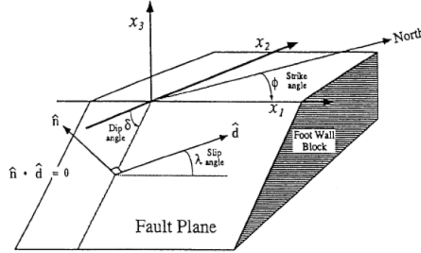 In version 2012, a new tool that can assist undertaking of Tsunami-simulations is introduced: earthquake bathymetry adjustment tool. For several years, it has been possible to work with time varying bathymetries (using the landslide option) in MIKE 21 Classic. The usability of this feature is now enhanced, as it will be easier to simulate tsunamis using the new tool. The earthquake bathymetry adjustment tool calculates sea bottom displacements that occur during an earthquake. The output is a time-varying bathymetry file, which can be used in MIKE 21 HD (classic) with the landslide option to generate wave propagation.
The method for calculation of the sea bottom displacements is an amplified version of the double-couple method developed by Okada (1985). The necessary input data for earthquakes can be retrieved from public databases. The tool is available in the MIKE 21 Toolbox in a new group called Seismology.
MIKE MARINE GIS will be discontinued
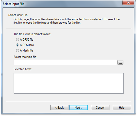 MIKE MARINE GIS will be discontinued and will not be available on the MIKE by DHI 2012 DVD. It has been evaluated that the user base for MIKE MARINE GIS was not sufficient to maintain the programme on the Esri platform. However, in version 2012, many of the tools that were previously available through MIKE MARINE GIS, have been transferred into MIKE Zero. Thus, we are enhancing the functionalities available for most users: -
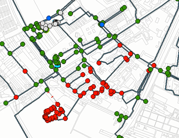 The costs of pipe failures in water distribution networks are increasing and are forcing operators and utility managers to develop strategies and solutions to identify and replace critical pipes. With the upcoming release of MIKE URBAN, a new set of advisor tools will be available to support these processes.
Pipe criticality modelling will predict how the water distribution system responds to: -
.
We are gradually approaching the release of the MIKE by DHI software package 2012, which is scheduled for this October. As in previous issues of our newsletter, we would like to disclose a preview of the many new and exciting features, which we hope will improve your experience when using the software products, both with regard to usability, productivity, and enhanced applications.
MIKE 21: Earthquake bathymetry adjustment tool
The method for calculation of the sea bottom displacements is an amplified version of the double-couple method developed by Okada (1985). The necessary input data for earthquakes can be retrieved from public databases. The tool is available in the MIKE 21 Toolbox in a new group called Seismology.
MIKE MARINE GIS will be discontinued
- Tools for creation of transects, profiles, baselines, and coastlines are included in the bathymetry editor
- The MIKE Zero tool “Geo Referencing Image File” has been extended to read and convert Esri world format files to DHI world file format
- The MIKE2SHP tool is extended to support mesh and dfsu files
Pipe criticality modelling will predict how the water distribution system responds to: -
- Pipe break situations
- Planned reconstructions
- Limited water supply
- Storage tanks: reports tanks that are either drained or overflows during the simulation, reports if the tanks are balanced within the simulation
- Pumps: reports pumps that are operated close to their maximum capacity
- Unit head loss: reports pipes with too high unit head loss
- Service pressure: reports excessive pressure that exceed the service criteria
- Pipe flow: reports reverse flow in pipes
- Flow velocity: reports excessive flow velocity
.
Friday, 6 July 2012
Previews of MIKE by DHI Release 2012
As mentioned in the previous issues of our newsletter, we would like to disclose some previews of the upcoming MIKE by DHI software package 2012, which is scheduled to be released this September. The release will contain various new and exciting features, which we hope will improve your experience when using the software products, both with regard to usability, productivity, and enhanced applications.
MIKE 21: New wave spectra converter
With the primary goal to improve and ease the generation of boundary conditions for MIKE 21 SW, the upcoming 2012 version will include a new Wave Spectra Converter tool in the wave toolbox.
Boundary conditions for MIKE 21 SW are often based on integral wave parameters (significant wave height, peak wave period, mean wave direction, etc.) available from public sources. Actually, full wave spectral information is often available but it has been complicated to generate the required data for a MIKE 21 SW boundary. This new tool will solve this problem by making it possible to manipulate full wave spectra, including the generation of fully spectral boundary data for MIKE 21 SW.
Please click on the illustration to view larger version.

FEFLOW 6.1: Visualising the groundwater surface
With the upcoming release 2012, modelling groundwater with FEFLOW is scheduled to take an important step forward by improving the usability, comprehensibility and speeding up the workflow process.
Visualising the groundwater surface improves the understanding of groundwater models dramatically. Using the pressure, this visualisation can be achieved by restricting the parameters’ range to zero. This is already possible with FEFLOW 6.0, but requires some effort in order to adjust the view settings. With the new FEFLOW 6.1, zero pressure isosurfaces are added for the 3D and zero pressure isolines for the 2D views. Both become directly available when plotting the pressure in the view components and thus speeding up the visualisation process.
Please click on the image, to view a larger version.
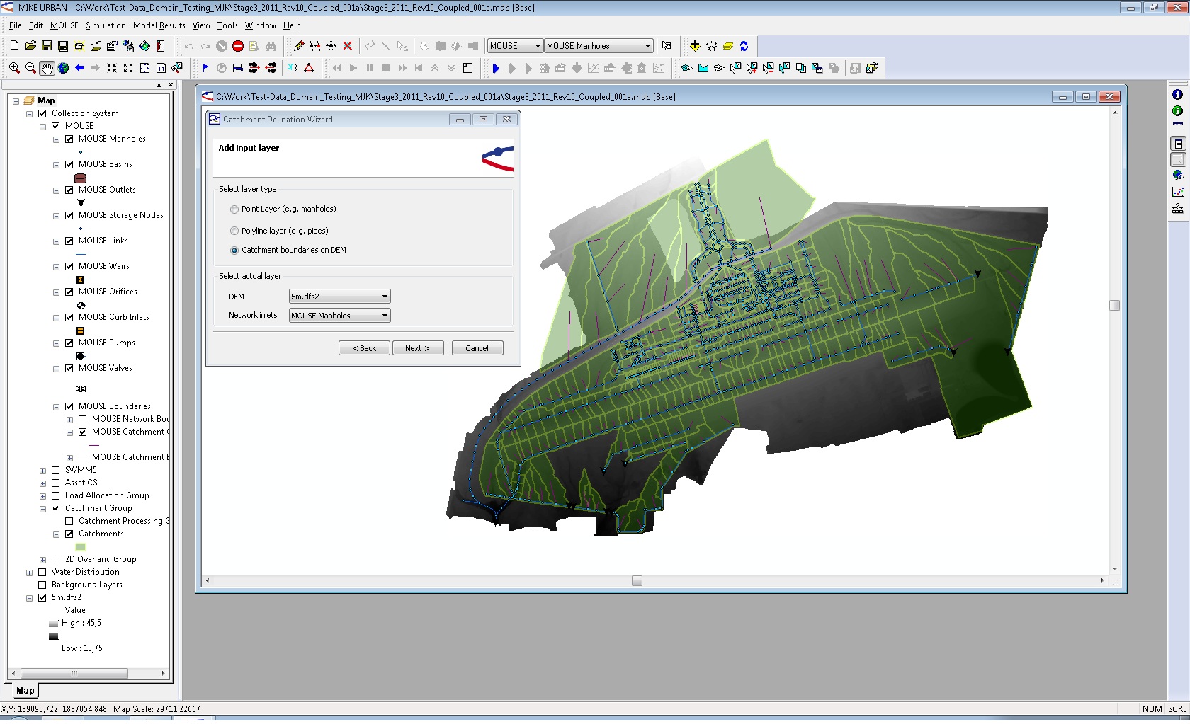
MIKE URBAN: Catchment delineation from digital elevation models
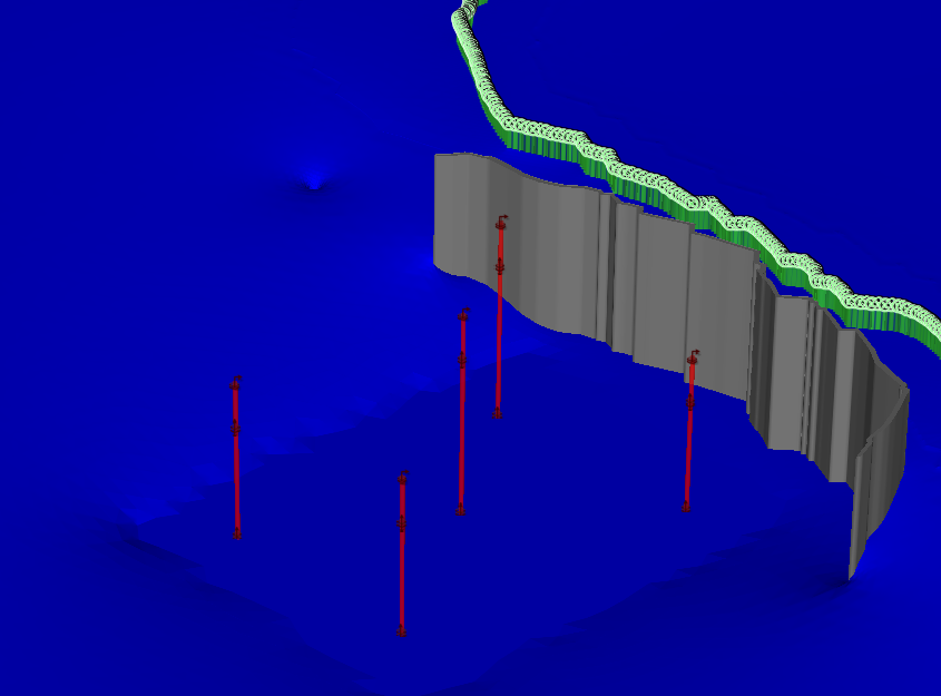
Catchment delineation is one of the essential steps for surface-runoff modelling. With MIKE URBAN version 2012 catchments, as a basic physical entity of the landscape, can be derived easily from digital elevation models (DEM). The number of available DEMs as well as the spatial resolution has been increased rapidly over the last years. Using this delineation technique will improve accuracy of the catchment delineation compared to a pure geometrical method (e.g. Thiessen polygons). The technique involved is well known as it is already utilised in MIKE BASIN.
Please click on the image to view a larger version.
As mentioned in the previous issues of our newsletter, we would like to disclose some previews of the upcoming MIKE by DHI software package 2012, which is scheduled to be released this September. The release will contain various new and exciting features, which we hope will improve your experience when using the software products, both with regard to usability, productivity, and enhanced applications.
MIKE 21: New wave spectra converter
With the primary goal to improve and ease the generation of boundary conditions for MIKE 21 SW, the upcoming 2012 version will include a new Wave Spectra Converter tool in the wave toolbox.
Boundary conditions for MIKE 21 SW are often based on integral wave parameters (significant wave height, peak wave period, mean wave direction, etc.) available from public sources. Actually, full wave spectral information is often available but it has been complicated to generate the required data for a MIKE 21 SW boundary. This new tool will solve this problem by making it possible to manipulate full wave spectra, including the generation of fully spectral boundary data for MIKE 21 SW.
Please click on the illustration to view larger version.
FEFLOW 6.1: Visualising the groundwater surface
With the upcoming release 2012, modelling groundwater with FEFLOW is scheduled to take an important step forward by improving the usability, comprehensibility and speeding up the workflow process.
Visualising the groundwater surface improves the understanding of groundwater models dramatically. Using the pressure, this visualisation can be achieved by restricting the parameters’ range to zero. This is already possible with FEFLOW 6.0, but requires some effort in order to adjust the view settings. With the new FEFLOW 6.1, zero pressure isosurfaces are added for the 3D and zero pressure isolines for the 2D views. Both become directly available when plotting the pressure in the view components and thus speeding up the visualisation process.
Please click on the image, to view a larger version.
MIKE URBAN: Catchment delineation from digital elevation models
Catchment delineation is one of the essential steps for surface-runoff modelling. With MIKE URBAN version 2012 catchments, as a basic physical entity of the landscape, can be derived easily from digital elevation models (DEM). The number of available DEMs as well as the spatial resolution has been increased rapidly over the last years. Using this delineation technique will improve accuracy of the catchment delineation compared to a pure geometrical method (e.g. Thiessen polygons). The technique involved is well known as it is already utilised in MIKE BASIN.
Please click on the image to view a larger version.
Tuesday, 13 March 2012
Previews of MIKE by DHI 2012 Release
As detailed in the February 2012 issue of our newsletter, we would like to present some previews of the upcoming MIKE by DHI software package 2012, which is scheduled to be released this September. The release will contain various new and exciting features, which we hope will improve your experience when using the software products, both with regard to usability, productivity, and enhanced applications.
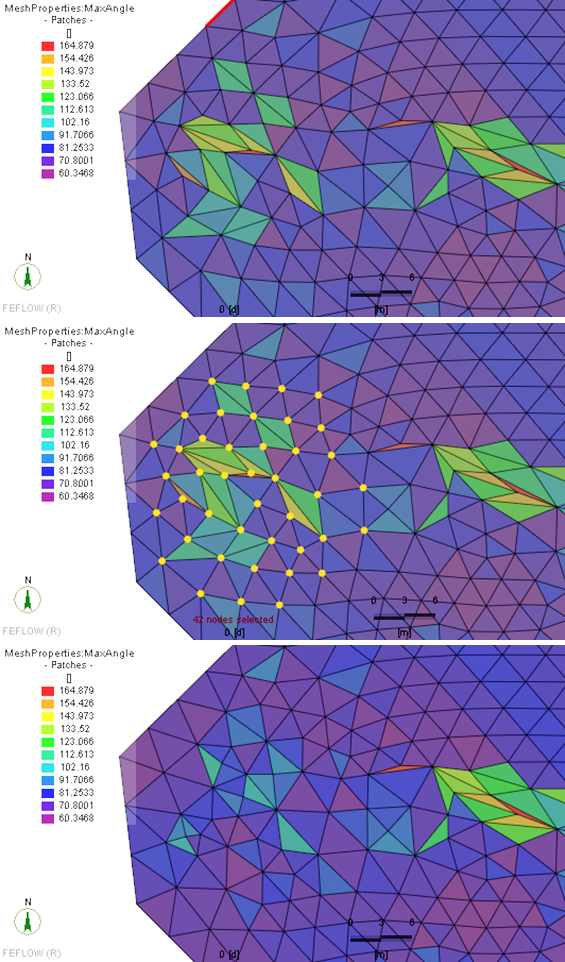
FEFLOW 6.1: Selective Mesh Smoothing for Finite-Element Meshes
 Now you can look forward to improved model quality and even faster modelling with the upcoming FEFLOW 6.1!
Smoothing a finite-element mesh can significantly improve the quality of a mesh that, in some cases, might be unsatisfactory after the generation process due to the presence of too many triangles with acute angles. Within groundwater modelling it is essential to keep hydraulic structures, e.g. well locations and other structures defined by the user at their original position. In FEFLOW 6.0, only a global mesh-smoothing option was available, which does not provide the means to exclude selected mesh nodes from shifting positions during the smoothing process.
With the upcoming version of FEFLOW 6.1, we have improved the smoothing functionality significantly: Smoothing can now be applied in selected areas of the finite-element mesh, only allowing maintaining the original positions of boundary conditions etc. as defined by the modeller.
WEST: How to convert plant layouts and experiments from older WEST versions?
The new WEST3 conversion tool allows for converting plant layouts and experiments from WEST 3.7.6 to WEST 2011. It will be available with the release 2012 and via download at the MIKE by DHI website.
Layouts that are based on the standard WEST model library are supported without further ado. During conversion, the user can choose whether to adopt the new WEST 2011 icons, or the old WEST 3.7.6 icons for the converted layout. The conversion tool does not require WEST 3.7.6 to be installed. However, it does require a valid WEST 2011 license.
Please do not hesitate to contact MIKE by DHI support if you have any questions related to WEST, or how to get the most out of the software.
MIKE URBAN: Storm Water Tools
With the release of MIKE URBAN 2012, the Storm Water Tools will be fully implemented into MIKE URBAN using either MOUSE or SWMM as simulation engine.
The MIKE URBAN Storm Water Tools focus on building the Storm Water model within a 1D framework. The tools supplement the standard MIKE URBAN installation by empowering the user with the ability to carry out:
As detailed in the February 2012 issue of our newsletter, we would like to present some previews of the upcoming MIKE by DHI software package 2012, which is scheduled to be released this September. The release will contain various new and exciting features, which we hope will improve your experience when using the software products, both with regard to usability, productivity, and enhanced applications.
FEFLOW 6.1: Selective Mesh Smoothing for Finite-Element Meshes
Smoothing a finite-element mesh can significantly improve the quality of a mesh that, in some cases, might be unsatisfactory after the generation process due to the presence of too many triangles with acute angles. Within groundwater modelling it is essential to keep hydraulic structures, e.g. well locations and other structures defined by the user at their original position. In FEFLOW 6.0, only a global mesh-smoothing option was available, which does not provide the means to exclude selected mesh nodes from shifting positions during the smoothing process.
With the upcoming version of FEFLOW 6.1, we have improved the smoothing functionality significantly: Smoothing can now be applied in selected areas of the finite-element mesh, only allowing maintaining the original positions of boundary conditions etc. as defined by the modeller.
WEST: How to convert plant layouts and experiments from older WEST versions?
The new WEST3 conversion tool allows for converting plant layouts and experiments from WEST 3.7.6 to WEST 2011. It will be available with the release 2012 and via download at the MIKE by DHI website.
Layouts that are based on the standard WEST model library are supported without further ado. During conversion, the user can choose whether to adopt the new WEST 2011 icons, or the old WEST 3.7.6 icons for the converted layout. The conversion tool does not require WEST 3.7.6 to be installed. However, it does require a valid WEST 2011 license.
Please do not hesitate to contact MIKE by DHI support if you have any questions related to WEST, or how to get the most out of the software.
MIKE URBAN: Storm Water Tools
With the release of MIKE URBAN 2012, the Storm Water Tools will be fully implemented into MIKE URBAN using either MOUSE or SWMM as simulation engine.
The MIKE URBAN Storm Water Tools focus on building the Storm Water model within a 1D framework. The tools supplement the standard MIKE URBAN installation by empowering the user with the ability to carry out:
- Lateral snapping of digitised rivers to the lowest point in DEM
- Cross section extractions from DEM
- Auto connections of overland network to sewer network
- Sequential labelling of nodes
- Catchment slope and length calculations
Highlights from The Network (March 2012)
The latest MIKE by DHI NetWork newsletter has been published, and a selected article is presented below: -
Application Examples
The newsletter can be viewed online here.
- Protecting clean drinking water from Lake Ontario, Canada:
Most of the North American region and in particular Ontario’s 13 million residents are highly dependent on clean drinking water from one of the Great Lakes. Thus, as contamination of the lakes could have severe consequences for many communities, a study was initiated to investigate potential threats to the water quality of Lake Ontario.
As a part of Ontario’s Source Water Protection program, a group called the Lake Ontario Collaborative was formed to study the potential threats to the drinking water. They have investigated potential impacts that activities on land, such as potential spills from surrounding waste water treatment plants, nuclear power plants, petroleum pipelines, and industrial facilities could have on the contamination of the water quality at the areas of intakes. For this purpose, they used an events-based approach, where potential spills were modelled by calculating the hydrodynamics as well as different aspects of the water quality. By using a full three dimensional illustration of water motion, including thermodynamics, it was possible to make accurate simulations and predictions of water currents in the lake and simulate the potential damage of a spill scenario.
As a result, they were able to develop intake protection zones. The zones were used to help raise awareness of the potential environmental and health risks that potential spills could entail as well as guide the preparation of emergency response planning in the event of a spill in the future. Want to read more? Click here.
To subscribe to the newsletter(s), please visit http://www.graphicmail.com/rwcode/subscribe.aspx?SiteID=3526&Mode=subscribe
Wednesday, 15 February 2012
Previews of MIKE by DHI 2012 Release
In the coming issues of our MIKE by DHI NetWork newsletter, we would like to disclose some previews of the new MIKE by DHI software package 2012, which is scheduled to be released this summer. The release will contain various new and exciting features, which we hope will improve your experience when using the software products, both with regard to usability, productivity, and enhanced applications.
Improvements for MIKE Animator in development
In 2012, MIKE Animator is to be replaced with MIKE Animator Plus. Compared to the existing MIKE Animator the new MIKE Animator Plus will offer an extended set of features. The most important of these new scheduled features are be:
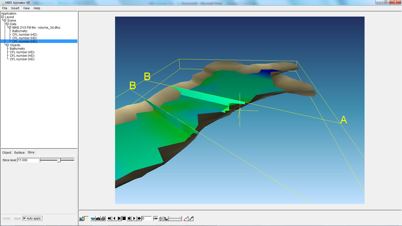
The above example shows a MIKE 3 Flexible Mesh result file with two vertical and one horizontal slice. This new feature will allow the user to get a much better overview of large 3-dimensional result files than ever before.
Littoral Processes FM: Re-design and development of LITPACK
In version 2011, the first step of the re-design of LITPACK was released, including the modules LITSTP and LITDRIFT. In the scheduled release for 2012, this re-design continues and includes the functionalities included in LITLINE.
The redesign constitutes an important milestone in the development of the system with regard to improved usability and integration into the coupled FM modelling system. The most obvious changes include the new user interface, which have the same look and feel as the rest of the MIKE Zero based products, including MIKE 21. Also the file formats have been changed. There will be one common set-up (pfs) file for all LITPACK-modules and the consequent use of standardised dfs-file formats has made it possible to introduce a higher flexibility when defining input- and output data. In this sense, one of the improvements included in the release in 2012 is the ability to work with an unlimited number of wave climates along the coastline, defined in a dfs1-file. Furthermore, all data in Littoral Processes FM will be geo-referenced, something which also makes it possible to display data in a graphic, geo-referenced view.
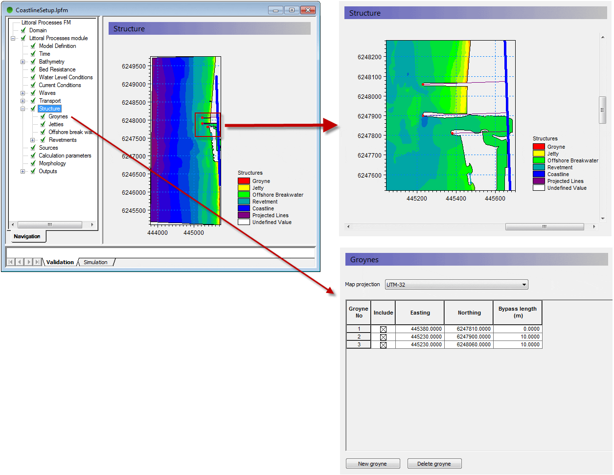
The above example shows the geographic positioning of groyne structures, with a mesh file shown as background.
Behind the scenes of MIKE URBAN 2012
Also MIKE URBAN users will notice improvements in 2012, where the new MIKE URBAN will transform the way people use hydraulic software. Be more productive and take advantage of the new, scheduled processing features of MIKE URBAN.
Currently our developers work hard to implement calibration plots and reports inside MIKE URBAN. This functionality will support plots of measured and simulated data. MIKE URBAN users will benefit from the possibility to generate series of calibration plots showing corresponding values of measured and simulated data along with comparison statistics in a tabular form. Find out more about other features of MIKE URBAN in one of our next newsletters.
In the coming issues of our MIKE by DHI NetWork newsletter, we would like to disclose some previews of the new MIKE by DHI software package 2012, which is scheduled to be released this summer. The release will contain various new and exciting features, which we hope will improve your experience when using the software products, both with regard to usability, productivity, and enhanced applications.
Improvements for MIKE Animator in development
In 2012, MIKE Animator is to be replaced with MIKE Animator Plus. Compared to the existing MIKE Animator the new MIKE Animator Plus will offer an extended set of features. The most important of these new scheduled features are be:
- Support for MIKE 3 Flexible Mesh result files - including vertical and horizontal slices, sigma layered slices and isosurfaces.
- Support for MIKE 3 Classic result files - including vertical and horizontal slices, sigma layered slices and isosurfaces.
- Extended image draping – meaning that multiple geo-referenced images can be rectified online and draped onto selected surfaces
- Import of solids – solids can be buildings, dams or other types of structures.
The above example shows a MIKE 3 Flexible Mesh result file with two vertical and one horizontal slice. This new feature will allow the user to get a much better overview of large 3-dimensional result files than ever before.
Littoral Processes FM: Re-design and development of LITPACK
In version 2011, the first step of the re-design of LITPACK was released, including the modules LITSTP and LITDRIFT. In the scheduled release for 2012, this re-design continues and includes the functionalities included in LITLINE.
The redesign constitutes an important milestone in the development of the system with regard to improved usability and integration into the coupled FM modelling system. The most obvious changes include the new user interface, which have the same look and feel as the rest of the MIKE Zero based products, including MIKE 21. Also the file formats have been changed. There will be one common set-up (pfs) file for all LITPACK-modules and the consequent use of standardised dfs-file formats has made it possible to introduce a higher flexibility when defining input- and output data. In this sense, one of the improvements included in the release in 2012 is the ability to work with an unlimited number of wave climates along the coastline, defined in a dfs1-file. Furthermore, all data in Littoral Processes FM will be geo-referenced, something which also makes it possible to display data in a graphic, geo-referenced view.
The above example shows the geographic positioning of groyne structures, with a mesh file shown as background.
Behind the scenes of MIKE URBAN 2012
Also MIKE URBAN users will notice improvements in 2012, where the new MIKE URBAN will transform the way people use hydraulic software. Be more productive and take advantage of the new, scheduled processing features of MIKE URBAN.
Currently our developers work hard to implement calibration plots and reports inside MIKE URBAN. This functionality will support plots of measured and simulated data. MIKE URBAN users will benefit from the possibility to generate series of calibration plots showing corresponding values of measured and simulated data along with comparison statistics in a tabular form. Find out more about other features of MIKE URBAN in one of our next newsletters.
Thursday, 3 February 2011
Cities
 Release 2011 of MIKE URBAN is another significant milestone. Important new features have been added that further support the work flow, increase your productivity and set new standards for what can be done in urban water modelling.
Water distribution
Release 2011 is another need-to-have release for water distribution modellers. A range of new features to enhance the usability have been implemented such as:
1 Pressure dependent demands
Traditionally, water demands are defined prior to the simulation and thus independent of the actual pressure. With Release 2011, the Wagner equation can be used to adjust the node demands based on the available pressure. This makes it possible to simulate system shutdown, maintenance and intermittent water supply systems.
2 Reliability analysis
The Reliability Analysis Tool allows you to analyse hydraulic and water quality results of any steady state or extended period analysis and to investigate the reliability in terms of exceeded maximum and/or minimum values of pressures, flows, water quality, or any other result item.
Simplification tool
The simplification tool has been enhanced to include:
Release 2011 of MIKE URBAN includes three new tools to increase your efficiency when building and maintaining models:
1 Database comparison and redoing modifications
This tool will report on differences between two MIKE URBAN databases. Records that are different will be reported as changed, deleted or added. For records which have changed, the attributes that are different will be highlighted. The differences can be saved to a file, which can be used to automatically redo the changes at a later stage, eg when redoing modifications after import.
2 Combining detailed and simplified models
This tool can be used to combine a detailed and a simplified model into a mixed model with both detailed and simplified areas.
3 Comparing results between models
With this tool you can compare two sets of model results at selected locations in batch mode.
Boundary Display in Map View
Boundary conditions are displayed in the map view including: discharge and water level boundaries in MOUSE and SWMM models, rainfall, temperature, evapotranspiration in catchments, as well as water demands in WD models.
Generic Features
Amongst the new generic features in 2011 in particular the climate change tool adds value for MIKE URBAN users. This tool provides climate model output (approved by IPCC) and applies these to make climate change assessment through automated modification of boundary conditions.
.

Water distribution
Release 2011 is another need-to-have release for water distribution modellers. A range of new features to enhance the usability have been implemented such as:
1 Pressure dependent demands
Traditionally, water demands are defined prior to the simulation and thus independent of the actual pressure. With Release 2011, the Wagner equation can be used to adjust the node demands based on the available pressure. This makes it possible to simulate system shutdown, maintenance and intermittent water supply systems.
2 Reliability analysis
The Reliability Analysis Tool allows you to analyse hydraulic and water quality results of any steady state or extended period analysis and to investigate the reliability in terms of exceeded maximum and/or minimum values of pressures, flows, water quality, or any other result item.
Simplification tool
The simplification tool has been enhanced to include:
- The choice of what not to simplify
- Change in flow direction as a new pipe-merge criteria
- Easy comparison of results from detailed and simplified models
- Detailed summary reporting on what has been merged and removed
- Saving simplification settings in a file
- Batch execution of multiple simplifications based on several settings files
Release 2011 of MIKE URBAN includes three new tools to increase your efficiency when building and maintaining models:
1 Database comparison and redoing modifications
This tool will report on differences between two MIKE URBAN databases. Records that are different will be reported as changed, deleted or added. For records which have changed, the attributes that are different will be highlighted. The differences can be saved to a file, which can be used to automatically redo the changes at a later stage, eg when redoing modifications after import.
2 Combining detailed and simplified models
This tool can be used to combine a detailed and a simplified model into a mixed model with both detailed and simplified areas.
3 Comparing results between models
With this tool you can compare two sets of model results at selected locations in batch mode.
Boundary Display in Map View
Boundary conditions are displayed in the map view including: discharge and water level boundaries in MOUSE and SWMM models, rainfall, temperature, evapotranspiration in catchments, as well as water demands in WD models.
Generic Features
Amongst the new generic features in 2011 in particular the climate change tool adds value for MIKE URBAN users. This tool provides climate model output (approved by IPCC) and applies these to make climate change assessment through automated modification of boundary conditions.
.
Subscribe to:
Posts
(Atom)
Follow DHI...


