Showing posts with label Tips. Show all posts
Showing posts with label Tips. Show all posts
Thursday, 5 December 2013
MIKE to Google Earth Datum Shift
 Google Earth is using the ellipsoid WGS84 to define geo-positions on the earth. If the dfs2 file uses a projection that is based on another ellipsoid the area may not be displayed correctly compared to the satellite images. In this case it may be necessary to apply Datum shift in addition to the automatic coordinate transformation in order for the image to be located correctly.
Here you can specify the parameters needed to transfer the data from the defined map projection into the domain used by Google Earth.
You can read more about Datum Conversion in the Geodesy manual supplied with the installation (MIKE_Zero_Geodesy.pdf).
See also: http://www.arcwebservices.com/arcwebonline/services/dattrans.htm
For example: -

Here you can specify the parameters needed to transfer the data from the defined map projection into the domain used by Google Earth.
You can read more about Datum Conversion in the Geodesy manual supplied with the installation (MIKE_Zero_Geodesy.pdf).
See also: http://www.arcwebservices.com/arcwebonline/services/dattrans.htm
For example: -
1195 OSGB_1936_To_WGS_1984_1
GEOGTRAN["OSGB_1936_To_WGS_1984_1",GEOGCS["GCS_OSGB_1936",DATUM["D_OSGB_1936",SPHEROID["Airy_1830",6377563.396,299.3249646]],PRIMEM["Greenwich",0.0],UNIT["Degree",0.0174532925199433]],GEOGCS["GCS_WGS_1984",DATUM["D_WGS_1984",SPHEROID["WGS_1984",6378137.0,298.257223563]],PRIMEM["Greenwich",0.0],UNIT["Degree",0.0174532925199433]],METHOD["Geocentric_Translation"],PARAMETER["X_Axis_Translation",375.0],PARAMETER["Y_Axis_Translation",-111.0],PARAMETER["Z_Axis_Translation",431.0]]
Thursday, 29 November 2012
MIKE 21 Quick Start Guide (Flexible Mesh Series)
Over the past few months, we have prepared several short instructional documents in the use of the MIKE Zero Mesh Generator, MIKE 21 FMHD and MIKE 21 SW from a UK perspective. These instructions have been collated into the informal working document 'MIKE 21 Quick Start Guide' below: -
We have been working hard to enhance our User Manuals and Scientific Documentation. For example, the above informal guide can be augmented by our new Mesh Generator Step-by-step Guide (2012): -
How to Create a Directional Wave Spectrum for Input to MIKE 21 SW from Buoy Data
In order to make best use of the new Wave Spectra Converter tool available in Release 2012, some pre-processing of wave buoy data is generally required. In response to a number of recent enquiries, we have prepared the following informal guidance: -
Oil Spill Modelling
It is important to note that the methodologies of the old and new oil spill models in MIKE 21/3 are very different, and a direct comparison is difficult. However, in order to provide some basic guidance, we have developed the following comparison document and associated example models (provided here for information and discussion only): -
Over the past few months, we have prepared several short instructional documents in the use of the MIKE Zero Mesh Generator, MIKE 21 FMHD and MIKE 21 SW from a UK perspective. These instructions have been collated into the informal working document 'MIKE 21 Quick Start Guide' below: -
We have been working hard to enhance our User Manuals and Scientific Documentation. For example, the above informal guide can be augmented by our new Mesh Generator Step-by-step Guide (2012): -
How to Create a Directional Wave Spectrum for Input to MIKE 21 SW from Buoy Data
In order to make best use of the new Wave Spectra Converter tool available in Release 2012, some pre-processing of wave buoy data is generally required. In response to a number of recent enquiries, we have prepared the following informal guidance: -
Oil Spill Modelling
It is important to note that the methodologies of the old and new oil spill models in MIKE 21/3 are very different, and a direct comparison is difficult. However, in order to provide some basic guidance, we have developed the following comparison document and associated example models (provided here for information and discussion only): -
Monday, 9 April 2012
Example Procedure for Calculating Flooding due to Overtopping of Defences by Wave Action
Ultimate Aim
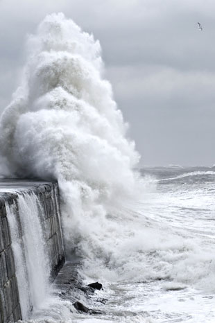 The standard approach to calculating wave overtopping volumes is through the use of EuroTop (http://www.overtopping-manual.com/), the European Overtopping Manual, accessed via the internet and developed from a combined update of the Environment Agency’s ‘Overtopping of Seawalls: Design and Assessment Manual’ (R&D Technical Report W178, 1999), the Dutch ‘Technical Report: Wave run-up and wave overtopping at dikes’ (TAW, 2002 English edition) and the German ‘Die Küste’ (EAK, 2002).
This Manual offers a number of methods to calculate wave overtopping at a range of different coastal structures. Common to each method is the requirement for wave climate at the toe of the structure. It is the calculation of these parameters that is the most significant challenge in the correct usage of EuroTop. Use of nearshore or even offshore waves can result in incorrect estimation of overtopping volumes.
This methodology offers some guidance to achieving the required values for correct use of EuroTop.
Step by Step Method
Please Note: This example methodology is for advice only. No liability for the consequences of any actions taken on the basis of the advice provided is accepted.
Ultimate Aim
This Manual offers a number of methods to calculate wave overtopping at a range of different coastal structures. Common to each method is the requirement for wave climate at the toe of the structure. It is the calculation of these parameters that is the most significant challenge in the correct usage of EuroTop. Use of nearshore or even offshore waves can result in incorrect estimation of overtopping volumes.
This methodology offers some guidance to achieving the required values for correct use of EuroTop.
Step by Step Method
- Offshore wave conditions
The most accessible wave conditions are those available from the Met Office wave model. These are generally considered to be ‘offshore’ as they tend to be in relatively deep water. These can be applied as boundary conditions to an offshore wave transformation model. - Offshore wave transformation model
The MIKE 21 Spectral Wave (SW) model simulates wave growth due to wind action, transformation due to refraction and shoaling resulting from depth variations, and decay due to whitecapping, bottom friction and wave breaking. The effects of wave-current interaction, non-linear wave-wave interaction and diffraction are also included and areas which dry out can be included within the model.
MIKE 21 SW is applied on a flexible mesh so offshore areas can be defined with a relatively coarse resolution while inshore areas are resolved on a finer mesh. This allows acceptable run times to be balanced by high resolution in coastal areas. - Nearshore wave conditions
For an exposed simple coastline, it is tempting to use the output from MIKE 21 SW directly in EuroTop. Unless the defence structure has been included in the model at a high resolution, this may result in overestimation of overtopping as wave heights extracted from the model output at the coastline are unlikely to accurately represent the wave climate at the toe of the structure. For more complex coastlines where reflection is an important process, or for wave action within harbours, outputs from SW are unlikely to be suitable for use in EuroTop as the waves will not be representative of the climate at the toe of the structure.
Nearshore wave conditions (generally just offshore of the breaker zone) can be extracted from the MIKE 21 SW outputs and used as boundary conditions for a MIKE 21 Boussinesq Wave (BW) model which is a phase-resolving model that solves the shallow water equations for waves in nearshore areas using the Boussinesq approximation. - Nearshore wave transformation
MIKE 21 BW can be used in either 1D or 2D forms. If the coastline where the defence structures are located is relatively straight and is sectionally uniform (i.e. can be divided into a number of sections which have uniform defence structure properties and relatively uniform nearshore bathymetry), a 1D approach can be used to transform the nearshore waves along a profile normal to the defence structure. By including the defence structure geometry in the BW model bathymetry, the wave climate at the toe of the structure can be directly extracted from the 1D BW model results.
For more complex coastlines or harbour sites, a 2D approach may be required. Again, inclusion of the defence structures in the model bathymetry will ensure that the wave climate at the toe of the structure can be extracted directly from the model results, at any site along the defences where overtopping calculations are required. - Overtopping calculation
Having determined the wave climate at the toe of the defence structures, calculation of overtopping volumes using EuroTop can be undertaken. Resultant volumes can then be routed overland behind the defences using MIKE 21 or MIKE FLOOD.
Monday, 11 July 2011
MIKE FLOOD Mass Balance Check
Periodically, it is useful to perform a mass balance verification to make sure that the total volume of water entering and leaving the model at the upstream and downstream boundaries balances the quantity of water remaining in the model domain at the end of a simulation.
The calculation of mass balance is quite simple in MIKE 11 (1D only) and MIKE 21 (2D only) but a number of steps are currently required to perform the calculation in MIKE FLOOD (1D / 2D). An automated MIKE FLOOD water balance calculation (that sums the mass balance contributions from MIKE 11, MIKE URBAN and MIKE 21) is currently in development for the 2012 Release.
Several methods / tools can be used to calculate mass balance. The examples below showcase lesser known features of MIKE View and the MIKE Zero Grid Series Editor.
Assuming ∑Q_in = ∑Q_out + ΔM11_vol + ΔM21_vol
Calculate ∑Q_in and ∑Q_out using MIKE View
Launch the standard MIKE 11 results file (*.res11) in MIKE View. Choose the 'Select Gridpoints' icon or 'Plot > TS in Grid Points...'. Select 'Discharge' as the Data Type, then click 'OK'. Choose the Q-points nearest the inflow boundary to generate a Time Series Discharge plot. Right click anywhere within the plot, choose 'Accumulated Values...', then click 'Calculate'. Make a note of the accumulated discharge (m3).
Repeat for all remaining inflow / outflow boundaries.
Calculate ΔM11_vol using MIKE View
Launch the additional MIKE 11 results file (*HDAdd.res11) in MIKE View. Choose 'Plot > TS of System Data...'. Select 'Volume' as the Data Type, then click 'List'. Select 'Volume, Total Volume', the click 'Show Values'. Make a note of the volumes at the start and end of the simulation.
ΔM11_vol = M11_endvol - M11_initialvol
Calculate ΔM21_vol using MIKE Zero Grid Series Editor (MIKE FLOOD 'Classic')
 Launch the H,P,Q MIKE 21 results file (*.dfs2) in the Grid Series Editor (right click the results file in the Project Explorer and select 'Open With...'). Choose 'Tools > Calculate Statistics...'. Select 'Sub-Set' and navigate to the end of the simulation, then click 'Select Current'. Select the 'Statistics' tab, then make a note of the Mean Value (average water depth), the Number of Points and the model resolution (Grid spacing).
M21_endvol = H_mean * N_wetpoints * Δx * Δy
Repeat for initial volumes if applicable.
ΔM21_vol = M21_endvol - M21_initialvol
Open MIKE 21 boundaries add complexity but can be considered using the MIKE 21 Tool for Discharge Calculation (New File > MIKE 21 > MIKE 21 Toolbox > Hydrodynamics > Discharge Calculation).
As a general rule of thumb, mass errors should be less than 2%. If the mass error is greater than 2%, the cause and location of the mass error within the model schematisation should be identified and the consequence of this error assessed and improvements to the model considered. If the mass error is greater than 5%, then it suggests that the model schematisation is not robust and needs to be reviewed (Ref: Fluvial Design Guide).
.
Periodically, it is useful to perform a mass balance verification to make sure that the total volume of water entering and leaving the model at the upstream and downstream boundaries balances the quantity of water remaining in the model domain at the end of a simulation.
The calculation of mass balance is quite simple in MIKE 11 (1D only) and MIKE 21 (2D only) but a number of steps are currently required to perform the calculation in MIKE FLOOD (1D / 2D). An automated MIKE FLOOD water balance calculation (that sums the mass balance contributions from MIKE 11, MIKE URBAN and MIKE 21) is currently in development for the 2012 Release.
Several methods / tools can be used to calculate mass balance. The examples below showcase lesser known features of MIKE View and the MIKE Zero Grid Series Editor.
Assuming ∑Q_in = ∑Q_out + ΔM11_vol + ΔM21_vol
Calculate ∑Q_in and ∑Q_out using MIKE View
Launch the standard MIKE 11 results file (*.res11) in MIKE View. Choose the 'Select Gridpoints' icon or 'Plot > TS in Grid Points...'. Select 'Discharge' as the Data Type, then click 'OK'. Choose the Q-points nearest the inflow boundary to generate a Time Series Discharge plot. Right click anywhere within the plot, choose 'Accumulated Values...', then click 'Calculate'. Make a note of the accumulated discharge (m3).
Repeat for all remaining inflow / outflow boundaries.
Calculate ΔM11_vol using MIKE View
NB: Add 'Volume' results to the 'Add. Output' tab of the MIKE 11 HD Parameter file prior to running the MIKE FLOOD simulation.
Launch the additional MIKE 11 results file (*HDAdd.res11) in MIKE View. Choose 'Plot > TS of System Data...'. Select 'Volume' as the Data Type, then click 'List'. Select 'Volume, Total Volume', the click 'Show Values'. Make a note of the volumes at the start and end of the simulation.
ΔM11_vol = M11_endvol - M11_initialvol
Calculate ΔM21_vol using MIKE Zero Grid Series Editor (MIKE FLOOD 'Classic')

M21_endvol = H_mean * N_wetpoints * Δx * Δy
Repeat for initial volumes if applicable.
ΔM21_vol = M21_endvol - M21_initialvol
Open MIKE 21 boundaries add complexity but can be considered using the MIKE 21 Tool for Discharge Calculation (New File > MIKE 21 > MIKE 21 Toolbox > Hydrodynamics > Discharge Calculation).
For more information, please see the document 'MIKE 21 FLOW MODEL: HINTS AND RECOMMENDATIONS IN APPLICATIONS WITH SIGNIFICANT FLOODING AND DRYING' here http://www.mikebydhi.com/upload/dhisoftwarearchive/papersanddocs/hydrodynamics/MIKE21SignificantFlodryGuidelines.pdf
As a general rule of thumb, mass errors should be less than 2%. If the mass error is greater than 2%, the cause and location of the mass error within the model schematisation should be identified and the consequence of this error assessed and improvements to the model considered. If the mass error is greater than 5%, then it suggests that the model schematisation is not robust and needs to be reviewed (Ref: Fluvial Design Guide).
.
Subscribe to:
Posts
(Atom)
Follow DHI...


