Showing posts with label Offshore Wind Farms. Show all posts
Showing posts with label Offshore Wind Farms. Show all posts
Monday, 18 August 2014
SCOUR AROUND MARINE STRUCTURES: Dealing with scour related problems in water environments
Date: Thursday 23 Oct - Friday 24 Oct 2014
Location: DHI, Agern Allé 5, DK-2970 Hørsholm, Denmark
Language: English
This two-day, thematic course introduces you to the procedures of analysis related to assessing scour risk at marine structures. The focus is on offshore wind turbine foundations and how to protect against or mitigate the scour formation by applying scour protection systems of, for instance, rock dump or mattresses. After the course the participant will be able to identify and define scour issues, asses the risk of scour and possible mitigation solutions for various types of marine structures and obtain the recent knowledge gained over the last decade from significant development and research within the field of marine scour.
Scour is a well-known issue for hydraulic and marine engineering. Scour occurs when structures are placed on erodible beds and exposed to current and waves. The foundations of e.g. offshore wind turbines are often erected in harsh hydrodynamic environments, exposed to tidal currents and large waves individually or in combination. Therefore, it is essential to have a detailed understanding of how these hydrodynamic environments affects the structure as a whole, including the foundation and the interaction between flow, structure and sea bed to ensure short– and long term stability. Evidently, the formation of scour around marine structures can pose a threat to the structural stability and the cables transporting electricity. Read more...
Click here to sign up for the training course!
Date: Thursday 23 Oct - Friday 24 Oct 2014
Location: DHI, Agern Allé 5, DK-2970 Hørsholm, Denmark
Language: English
This two-day, thematic course introduces you to the procedures of analysis related to assessing scour risk at marine structures. The focus is on offshore wind turbine foundations and how to protect against or mitigate the scour formation by applying scour protection systems of, for instance, rock dump or mattresses. After the course the participant will be able to identify and define scour issues, asses the risk of scour and possible mitigation solutions for various types of marine structures and obtain the recent knowledge gained over the last decade from significant development and research within the field of marine scour.
Scour is a well-known issue for hydraulic and marine engineering. Scour occurs when structures are placed on erodible beds and exposed to current and waves. The foundations of e.g. offshore wind turbines are often erected in harsh hydrodynamic environments, exposed to tidal currents and large waves individually or in combination. Therefore, it is essential to have a detailed understanding of how these hydrodynamic environments affects the structure as a whole, including the foundation and the interaction between flow, structure and sea bed to ensure short– and long term stability. Evidently, the formation of scour around marine structures can pose a threat to the structural stability and the cables transporting electricity. Read more...
Click here to sign up for the training course!
Monday, 28 April 2014
We win a high-profile bird collision avoidance study in the United Kingdom
In collaboration with NIRAS and BirdLife Denmark, we’ve been awarded a high-profile research project focusing on the collision risks of birds at offshore wind farm.
Part of the Offshore Renewables Joint Industry Programme (ORJIP), this technically challenging project will quantify and interpret avoidance behaviour of key marine bird species. The results of the study will be used to obtain a more realistic estimate of bird collisions with offshore wind farms. Read more >>>
Additional project information
Providing the modelling software for a project using drones to analyse coastal erosion
We are a partner on the Innovative Methodologies for Coastal Environmental Monitoring and Analysis (MIRAMar) project in Italy. Researches will use our MIKE by DHI software for the modelling portion of the study.
The MIRAMar project is examining new ways to survey, monitor and analyse the effects of strong wind and waves on shorelines using small, remote-controlled, camera-equipped drones. A team of scientists, including Alessio Rovere (Junior Research Group Leader, the Centre of Marine Environmental Sciences and the Centre for Tropical Marine Ecology, University of Bremen) and Elisa Casella (Environmental Engineer, University of Genoa, Italy) are working on the project. Read more >>>
Additional project information
 Evaluating the future impact of land-use and development policies for the Elbow River Watershed
We helped Alberta Environment and Sustainable Resource Development (ESRD) and the University of Calgary develop an integrated dynamic modelling system for the Elbow River watershed.
This system will help stakeholders understand the potential impact of land-use changes and climate change scenarios on the Elbow River Watershed’s hydrological processes. Read more >>>
Additional project information
Conducting a flooding study for Jaslovske Bohunice Nuclear Power Plant in Slovakia
We helped Jaslovske Bohunice Nuclear Power Plant ensure it has adequate flood prevention measures in place in the event of extreme rainfall.
The tsunami that severely damaged Japan’s Fukushima Nuclear Power Plant on 11 March 2011 highlighted the global concern for ensuring the safety of nuclear power plants. After the tsunami, crisis managers in the nuclear energy sector started to prepare and upgrade risk studies, taking all possible sources of risk into account. Read more >>>
In collaboration with NIRAS and BirdLife Denmark, we’ve been awarded a high-profile research project focusing on the collision risks of birds at offshore wind farm.
Part of the Offshore Renewables Joint Industry Programme (ORJIP), this technically challenging project will quantify and interpret avoidance behaviour of key marine bird species. The results of the study will be used to obtain a more realistic estimate of bird collisions with offshore wind farms. Read more >>>
Additional project information
Providing the modelling software for a project using drones to analyse coastal erosion
We are a partner on the Innovative Methodologies for Coastal Environmental Monitoring and Analysis (MIRAMar) project in Italy. Researches will use our MIKE by DHI software for the modelling portion of the study.
The MIRAMar project is examining new ways to survey, monitor and analyse the effects of strong wind and waves on shorelines using small, remote-controlled, camera-equipped drones. A team of scientists, including Alessio Rovere (Junior Research Group Leader, the Centre of Marine Environmental Sciences and the Centre for Tropical Marine Ecology, University of Bremen) and Elisa Casella (Environmental Engineer, University of Genoa, Italy) are working on the project. Read more >>>
Additional project information
We helped Alberta Environment and Sustainable Resource Development (ESRD) and the University of Calgary develop an integrated dynamic modelling system for the Elbow River watershed.
This system will help stakeholders understand the potential impact of land-use changes and climate change scenarios on the Elbow River Watershed’s hydrological processes. Read more >>>
Additional project information
Conducting a flooding study for Jaslovske Bohunice Nuclear Power Plant in Slovakia
We helped Jaslovske Bohunice Nuclear Power Plant ensure it has adequate flood prevention measures in place in the event of extreme rainfall.
The tsunami that severely damaged Japan’s Fukushima Nuclear Power Plant on 11 March 2011 highlighted the global concern for ensuring the safety of nuclear power plants. After the tsunami, crisis managers in the nuclear energy sector started to prepare and upgrade risk studies, taking all possible sources of risk into account. Read more >>>
Sunday, 18 November 2012
Transforming abandoned mining pits into new lake districts
The mining industry can have severe consequences for regions and the surrounding landscape, impacting vegetation and wildlife negatively when mining production is abandoned. Rehabilitating old mining areas can be a highly difficult challenge and few succeed.
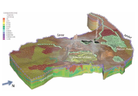 However, with the right strategies and tools available, abandoned mining pits can be turned from lifeless landscapes into prosperous manmade lake districts. This is what has been done in Eastern Germany, where DHI-WASY was able to provide accurate analysis and the right strategies for creating a new lake. For this purpose, integrated groundwater modelling was essential using among other products FEFLOW 6.1 and MIKE 11.
Click here to read more.
Read the full November 2012 Edition of the MIKE by DHI NetWork newsletter here.
Dynamic response of floating offshore wind turbines
As a member of the HYDRALAB-IV consortium, we offer access to research groups to conduct experimental studies in our wave basins. One of the projects selected by HYDRALAB's user selection panel for Transnational Access to our facilities concerns 'Dynamic Response of Floating offshore Structures under Random Waves and Wind Action'.
Other recent DHI news stories
The mining industry can have severe consequences for regions and the surrounding landscape, impacting vegetation and wildlife negatively when mining production is abandoned. Rehabilitating old mining areas can be a highly difficult challenge and few succeed.
Click here to read more.
Read the full November 2012 Edition of the MIKE by DHI NetWork newsletter here.
Dynamic response of floating offshore wind turbines
As a member of the HYDRALAB-IV consortium, we offer access to research groups to conduct experimental studies in our wave basins. One of the projects selected by HYDRALAB's user selection panel for Transnational Access to our facilities concerns 'Dynamic Response of Floating offshore Structures under Random Waves and Wind Action'.
Other recent DHI news stories
- We support IMPAQ in investigating zooplankton impacts on larval fish growth
- Development of innovative technology for treatment of hospital wastewater
- Testing floating wind turbines in DHI’s offshore basin
- We sign a new real-time forecasting contract with Slovenia
- EUPORIAS – the next step in seasonal forecasting
- Decommissioning a former nuclear weapons manufacturing facility
- We help to drive European wave and tidal power generation forward
Tuesday, 7 August 2012
Numerical modelling of moored vessel motion
DHI has developed the moored vessel response model WAMSIM. The WAMSIM model is an advanced numerical modelling software package designed to support decision makers with fast, accurate and cost effective predictions of motions and mooring forces affecting floating structures. The forcing comes from combined wind, current and wave action. The influence of breakwater and quay structures on the waves is included in the forcing via the hydrodynamics model. Using this tool enables operators to adopt effective mitigation measures early in the feasibility and design processes.
WAMSIM utilises the combined strength of MIKE by DHI’s wave and hydrodynamic models and the industry standard vessel response model WAMIT® by WAMIT Inc. WAMSIM provides time domain predictions of all motions and mooring forces, and can be used to produce informative 3D visualizations, for easy visualisation and result interpretation. The accuracy of WAMSIM has been thoroughly validated against field and laboratory measurements, and have been successfully utilized on projects at a across the globe.
Numerical Modelling of Moored Vessel Motion-DHI Solution
Predicting scour in offshore wind farms
 Our research into long-term scour predictions has borne fruit in the form of a specialty tool - WiTuS. With WiTuS, it is now possible to model long-term predictions on scouring around monopile type foundations – structures which form the bases of majority of the current and planned offshore wind farms.
Offshore wind farm establishment is an expensive affair. To add to it, there has been no system in place to predict scouring effects on monopiles over long time spans. Lack of predictability has been forcing investors to spend more on hefty protection measures, to shield monopiles against scouring. This significantly adds on to already heavy investment costs. Read more.
Learn more about WiTus in our new case story.
Oil Spill Modelling
 Oil spills pose a serious threat to the marine environment and can have dramatic impacts. With our state-of-the-art knowledge and modelling tools we can assist you in predicting these impacts and help you prepare the proper response at the right time.
Check out our new solution flyer to learn more.
DHI has developed the moored vessel response model WAMSIM. The WAMSIM model is an advanced numerical modelling software package designed to support decision makers with fast, accurate and cost effective predictions of motions and mooring forces affecting floating structures. The forcing comes from combined wind, current and wave action. The influence of breakwater and quay structures on the waves is included in the forcing via the hydrodynamics model. Using this tool enables operators to adopt effective mitigation measures early in the feasibility and design processes.
WAMSIM utilises the combined strength of MIKE by DHI’s wave and hydrodynamic models and the industry standard vessel response model WAMIT® by WAMIT Inc. WAMSIM provides time domain predictions of all motions and mooring forces, and can be used to produce informative 3D visualizations, for easy visualisation and result interpretation. The accuracy of WAMSIM has been thoroughly validated against field and laboratory measurements, and have been successfully utilized on projects at a across the globe.
Numerical Modelling of Moored Vessel Motion-DHI Solution
Predicting scour in offshore wind farms
Offshore wind farm establishment is an expensive affair. To add to it, there has been no system in place to predict scouring effects on monopiles over long time spans. Lack of predictability has been forcing investors to spend more on hefty protection measures, to shield monopiles against scouring. This significantly adds on to already heavy investment costs. Read more.
Learn more about WiTus in our new case story.
Oil Spill Modelling
Check out our new solution flyer to learn more.
Many more documents are available on the DHI Scribd channel.
Follow us on the new and continually updated DHI Scribd channel, to easily access and share our latest publications.
Click here
Scribd, the world's largest social reading and publishing site, ensures widespread access to our documents and offers easy sharing functionalities.

Subscribe to:
Posts
(Atom)
Follow DHI...


