Tuesday 10 April 2012

 |
 |
| 2D Flood Modelling in Urban Areas (Grantley Smith, University of Newcastle, NSW) | Wave resource assessment for Oyster farms using MIKE 21 (Ian Harris, Aquamarine Power) |
Please do not hesitate to contact any of us if you have any questions or unresolved feedback: -
- Simon Matthews on 01694 722795 or sm@dhigroup.com
- Steve Flood on 01752 691723 or sjf@dhigroup.com

Monday 9 April 2012
Meet us at Working in the Wet 2012 on Thursday 26th April 2012 in Winchester
Running since 2002, ICE South Maritime Group’s popular biennial conference is designed for professionals, students and those with a keen interest in the maritime field and, as ever, promises to be both informative and entertaining. Read more here.
DHI has its own stand to welcome clients and partners, to discuss the newest developments in the market, and to share visions and ideas on future opportunities.
If you would like to arrange a meeting in advance, please contact: -
- Nick Elderfield on nje@dhigroup.com
- Sonja Pans on spa@dhigroup.com
Example Procedure for Calculating Flooding due to Overtopping of Defences by Wave Action
Ultimate Aim
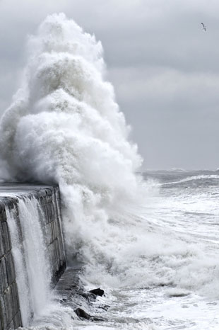 The standard approach to calculating wave overtopping volumes is through the use of EuroTop (http://www.overtopping-manual.com/), the European Overtopping Manual, accessed via the internet and developed from a combined update of the Environment Agency’s ‘Overtopping of Seawalls: Design and Assessment Manual’ (R&D Technical Report W178, 1999), the Dutch ‘Technical Report: Wave run-up and wave overtopping at dikes’ (TAW, 2002 English edition) and the German ‘Die Küste’ (EAK, 2002).
This Manual offers a number of methods to calculate wave overtopping at a range of different coastal structures. Common to each method is the requirement for wave climate at the toe of the structure. It is the calculation of these parameters that is the most significant challenge in the correct usage of EuroTop. Use of nearshore or even offshore waves can result in incorrect estimation of overtopping volumes.
This methodology offers some guidance to achieving the required values for correct use of EuroTop.
Step by Step Method
Please Note: This example methodology is for advice only. No liability for the consequences of any actions taken on the basis of the advice provided is accepted.
Ultimate Aim
This Manual offers a number of methods to calculate wave overtopping at a range of different coastal structures. Common to each method is the requirement for wave climate at the toe of the structure. It is the calculation of these parameters that is the most significant challenge in the correct usage of EuroTop. Use of nearshore or even offshore waves can result in incorrect estimation of overtopping volumes.
This methodology offers some guidance to achieving the required values for correct use of EuroTop.
Step by Step Method
- Offshore wave conditions
The most accessible wave conditions are those available from the Met Office wave model. These are generally considered to be ‘offshore’ as they tend to be in relatively deep water. These can be applied as boundary conditions to an offshore wave transformation model. - Offshore wave transformation model
The MIKE 21 Spectral Wave (SW) model simulates wave growth due to wind action, transformation due to refraction and shoaling resulting from depth variations, and decay due to whitecapping, bottom friction and wave breaking. The effects of wave-current interaction, non-linear wave-wave interaction and diffraction are also included and areas which dry out can be included within the model.
MIKE 21 SW is applied on a flexible mesh so offshore areas can be defined with a relatively coarse resolution while inshore areas are resolved on a finer mesh. This allows acceptable run times to be balanced by high resolution in coastal areas. - Nearshore wave conditions
For an exposed simple coastline, it is tempting to use the output from MIKE 21 SW directly in EuroTop. Unless the defence structure has been included in the model at a high resolution, this may result in overestimation of overtopping as wave heights extracted from the model output at the coastline are unlikely to accurately represent the wave climate at the toe of the structure. For more complex coastlines where reflection is an important process, or for wave action within harbours, outputs from SW are unlikely to be suitable for use in EuroTop as the waves will not be representative of the climate at the toe of the structure.
Nearshore wave conditions (generally just offshore of the breaker zone) can be extracted from the MIKE 21 SW outputs and used as boundary conditions for a MIKE 21 Boussinesq Wave (BW) model which is a phase-resolving model that solves the shallow water equations for waves in nearshore areas using the Boussinesq approximation. - Nearshore wave transformation
MIKE 21 BW can be used in either 1D or 2D forms. If the coastline where the defence structures are located is relatively straight and is sectionally uniform (i.e. can be divided into a number of sections which have uniform defence structure properties and relatively uniform nearshore bathymetry), a 1D approach can be used to transform the nearshore waves along a profile normal to the defence structure. By including the defence structure geometry in the BW model bathymetry, the wave climate at the toe of the structure can be directly extracted from the 1D BW model results.
For more complex coastlines or harbour sites, a 2D approach may be required. Again, inclusion of the defence structures in the model bathymetry will ensure that the wave climate at the toe of the structure can be extracted directly from the model results, at any site along the defences where overtopping calculations are required. - Overtopping calculation
Having determined the wave climate at the toe of the defence structures, calculation of overtopping volumes using EuroTop can be undertaken. Resultant volumes can then be routed overland behind the defences using MIKE 21 or MIKE FLOOD.
Subscribe to:
Posts
(Atom)
Follow DHI...


