Showing posts with label Newsletter. Show all posts
Showing posts with label Newsletter. Show all posts
Thursday, 1 May 2014

The world's water consumption rate is doubling every 20 years — twice as fast as the population growth rate. By 2025, water demand will exceed supply by 56%.
The critical need for water to sustain all aspects of human activity has driven us to inhabit floodplains and deltas close to rivers. Today, 82% of the global population lives in these areas and is exposed to a high risk of flooding.
We constantly strive to develop a robust understanding of the physical water environment as a precursor to any analyses influencing decision-making. Applying state-of-the-art modelling technologies and analytics ensures that we achieve this. We work closely with our clients and stakeholders to appreciate the water management issues that may affect their project outcomes. In so doing, we develop solutions that are appropriate, cost-effective and environmentally responsible.
Read our Newsletter to find out more about the work we have done in the field of 'Surface and groundwater' through few of our highlighted stories. If you have any questions or would like to know more, feel free to drop us a line. Read more >>>
Tuesday, 22 April 2014
Monday, 2 December 2013

Development of new modelling tools for national marine water planning based on ECO Lab
Our ecological modelling software, ECO Lab, will be used in a new project with the aim to develop an advanced set of dynamic modelling tools, which will be the official tools for marine water planning in Denmark in the coming years.
The project is initiated as a collaboration between DHI and Danish Centre for Environment and Energy (DCE). The project will develop and apply ecosystem models by using our MIKE by DHI software, ECO Lab, and addressing the governing coastal processes and ecosystem services such as sediment processes, sea grass, algal growth and oxygen depletion.
For more information, click here or contact Anders Erichsen, DHI.
You can also read more about ecological modelling by clicking the links below:
- Applying ECO Lab for solving ecosystem challenges
- Modelling the behaviour of organisms with ABM Lab in response to the environment
Enabling optimised construction of the London Array offshore wind farm
Our real-time system provided accurate forecasts of Metocean conditions on a detailed spatial and temporal scale for the world’s largest wind farm – London Array. This enabled London Array Ltd. – the consortium behind the wind farm – to optimise the construction of the offshore wind farm. The result: minimised delays and ensured safety for those working on the project.
Situated in the outer Thames Estuary, is the world’s largest offshore wind farm: the 1 GW London Array. Weather conditions in this area are often challenging, which made construction and installation of the wind farm difficult. As such, high-quality and reliable Metocean data was vital for the successful planning and installation of London Array’s foundations and turbines.
London Array Ltd. needed to be able to predict available weather windows. We used our 30 years of experience in Metocean forecasting for this purpose. This ensured that the London Array project benefitted from the most up-to-date and advanced technologies, combined with local experience of forecasting techniques and equipment.
By assisting London Array Ltd. with forecasting Metocean conditions, our system helped keep delays to a minimum during the construction phase. In addition, our system also enabled London Array Ltd. to efficiently plan maintenance work during the operations phase.
Read more.
CARM wins Australia’s national Environmental Engineering Excellence Award
On 20 November 2013, the Institution of Engineers Australia awarded the Computer Aided River Management (CARM) project the Environmental Engineering Excellence Award. This prestigious award honours the top achievements in environmental engineering and the sustainable use of natural resources. The award was received by our client State Water Corporation of New South Wales.
Our software is the backbone of CARM – a Decision Support System (DSS) based on MIKE CUSTOMISED by DHI components. CARM gives State Water Corporation an insight into the current and forecasted state of the Murrumbidgee River. It utilises a suite of MIKE by DHI models to reproduce key catchment and river processes for the entire 1,600 km river system, and combines them with real-time measurements. This allows river operators to combine dam releases with natural tributary inflows to deliver the right amount of water when and where it is needed.
For more information on the CARM project, click here
Read the October 2013 Edition of the DHI Group newsletter here.
Sunday, 18 November 2012
Transforming abandoned mining pits into new lake districts
The mining industry can have severe consequences for regions and the surrounding landscape, impacting vegetation and wildlife negatively when mining production is abandoned. Rehabilitating old mining areas can be a highly difficult challenge and few succeed.
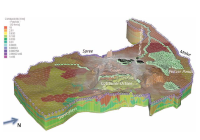 However, with the right strategies and tools available, abandoned mining pits can be turned from lifeless landscapes into prosperous manmade lake districts. This is what has been done in Eastern Germany, where DHI-WASY was able to provide accurate analysis and the right strategies for creating a new lake. For this purpose, integrated groundwater modelling was essential using among other products FEFLOW 6.1 and MIKE 11.
Click here to read more.
Read the full November 2012 Edition of the MIKE by DHI NetWork newsletter here.
Dynamic response of floating offshore wind turbines
As a member of the HYDRALAB-IV consortium, we offer access to research groups to conduct experimental studies in our wave basins. One of the projects selected by HYDRALAB's user selection panel for Transnational Access to our facilities concerns 'Dynamic Response of Floating offshore Structures under Random Waves and Wind Action'.
Other recent DHI news stories
The mining industry can have severe consequences for regions and the surrounding landscape, impacting vegetation and wildlife negatively when mining production is abandoned. Rehabilitating old mining areas can be a highly difficult challenge and few succeed.
Click here to read more.
Read the full November 2012 Edition of the MIKE by DHI NetWork newsletter here.
Dynamic response of floating offshore wind turbines
As a member of the HYDRALAB-IV consortium, we offer access to research groups to conduct experimental studies in our wave basins. One of the projects selected by HYDRALAB's user selection panel for Transnational Access to our facilities concerns 'Dynamic Response of Floating offshore Structures under Random Waves and Wind Action'.
Other recent DHI news stories
- We support IMPAQ in investigating zooplankton impacts on larval fish growth
- Development of innovative technology for treatment of hospital wastewater
- Testing floating wind turbines in DHI’s offshore basin
- We sign a new real-time forecasting contract with Slovenia
- EUPORIAS – the next step in seasonal forecasting
- Decommissioning a former nuclear weapons manufacturing facility
- We help to drive European wave and tidal power generation forward
Saturday, 14 July 2012

The latest MIKE by DHI NetWork newsletter (July 2012) has now been published. Selected highlights from this, and other recent, newsletters are presented below: -
Application Examples from Around the World
- MIKE 3 used for innovative project at the Maspalomas desalination plant in Spain: A new and innovative project in the Canary Islands in Spain has resulted in the successful development of an effective method for reducing the environmental impact of brine discharges on marine ecosystems. In order to mitigate the impact of large spreading brine discharges from desalination plants, which affect the benthic communities at the sea bottom, a study was made at the Maspalomas desalination plant in Gran Canaria. The feasibility study focused on applying Venturi effect ejectors in brine discharges versus conventional diffusers as a mechanism to improve the dilution processes at acceptable costs for new and existing plants. DHI contributed by developing and applying numerical models for the study of the brine dispersion, including a MIKE 3 model to simulate the brine plume far field, which was calibrated using measurements from several monitoring surveys. Read more here.
- Oil dispersion in Guanabara Bay in Rio de Janeiro, Brazil: DHI Brazil was recently requested to perform an oil dispersion modelling to support the development of an emergency plan for a port terminal in Guanabara Bay in Rio de Janeiro. As part of the emergency plan, an analysis of the effects of oil pollution incidents on the safety of life and the environment was performed, taking into account the sensitivity of the areas likely to be affected and the possibility of occurrence. The determination of these exposed areas was conducted through mathematical modelling. Thus, the hydrodynamic and oil dispersion modules of the modelling system MIKE by DHI were used to simulate different scenarios of accidental oil spills within the bay. Read more here.
- Protection of cruise terminal in Jamaica with MIKE 21: The Falmouth Terminal on the north shore of Jamaica is used by thousands of cruise line passengers each year, but the extreme hurricane events that occur in the region each year pose a flood risk of the terminal buildings. DHI performed comprehensive research and modelling to evaluate the best way to protect the cruise terminal buildings, even during extreme hurricane events in a highly complex bathymetric setting. For this purpose MIKE 21 PMS (Parabolic mild-slope) and MIKE 21 BW (Boussinesq Wave) was used to reproduce the energy dissipation due to wave breaking as well as the wave refraction and wave diffraction. Read more here.
- Uncertainty analysis to improve design criteria of wastewater treatment plants (WWTP): The Umbrella-DOUT initiative is a net of seven interconnected projects that aim at analysing how uncertainty is being tackled in wastewater treatment plant (WWTP) design. Design guidelines (Metcalf & Eddy, ATV, Grady, etc.) and safety factors are generally used to develop designs that ensure some effluent requirements (average ammonium below 3 mg/l; total nitrogen below 18 mg/l, etc.). Read more here.
- Researching the Grand-Lieu Lake in France with MIKE 21: The Science University of Nantes is using MIKE 21 software for ecosystems research of the Grand-Lieu Lake in France. The natural area of the Grand-Lieu Lake is well protected, but suffers an alarming evolution including phenomena such as fast erosion of the macrophytes belt, significantly decreasing biodiversity, early blooming of cyanobacteria phytoplankton, and negative sedimentary balance. Read more here.
- Modelling the Tohoku tsunami in Japan: One year has now passed since the tragic tsunami of 11 March 2011. Together with the Danish Authorities and especially the Royal Danish Embassy in Japan, DHI has provided assistance to Higashi Matsushima city, which is one of the hardest affected communities along the coastline of the Tohoku region. At Higashi Matsushima, the tsunami wave reached more than 10 m, propagated as far as 5 km inland, claiming at least 1039 lives of a population of 42,000, and destroyed more than 60 % of the city. Read more here.
- Modelling the 11 April mini-tsunami in the Indian Ocean: In the afternoon of 11 April 2012, an earthquake occurred 500 km off the north-western coast of Sumatra, near the region where the devastating Indian Ocean tsunami was generated in 2004. On 11 April, the earthquake was felt strongly in Sumatra, but also in Malaysia, Singapore, and even in places like Bangladesh and the Maldives. The level of awareness was high, and shortly after the earthquake a tsunami warning was issued for the entire Indian Ocean due to a well-functioning tsunami watch, which was set into effect only seven minutes after the earthquake. Fortunately, a large tsunami did not materialise. Read more here.
- Plotting MIKE 21 spill levels in MIKE FLOOD: Do you know how to compare MIKE FLOOD spill levels along lateral links with MIKE 11 longitudinal profile results? If not, click here to find a tip that will guide you through it.
To subscribe to the newsletter(s), please visit http://www.graphicmail.com/rwcode/subscribe.aspx?SiteID=3526&Mode=subscribe
.
Tuesday, 13 March 2012
Previews of MIKE by DHI 2012 Release
As detailed in the February 2012 issue of our newsletter, we would like to present some previews of the upcoming MIKE by DHI software package 2012, which is scheduled to be released this September. The release will contain various new and exciting features, which we hope will improve your experience when using the software products, both with regard to usability, productivity, and enhanced applications.
FEFLOW 6.1: Selective Mesh Smoothing for Finite-Element Meshes
 Now you can look forward to improved model quality and even faster modelling with the upcoming FEFLOW 6.1!
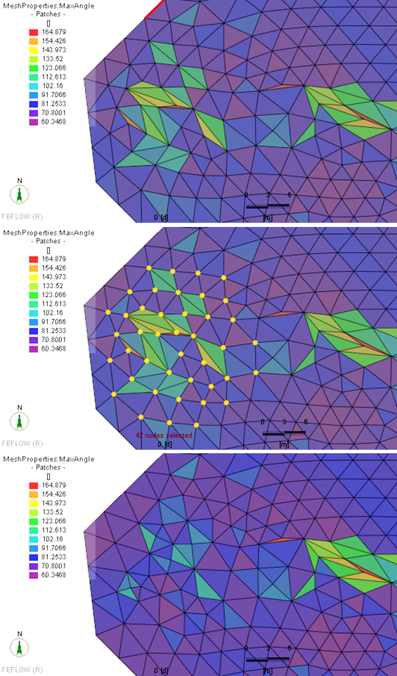
Smoothing a finite-element mesh can significantly improve the quality of a mesh that, in some cases, might be unsatisfactory after the generation process due to the presence of too many triangles with acute angles. Within groundwater modelling it is essential to keep hydraulic structures, e.g. well locations and other structures defined by the user at their original position. In FEFLOW 6.0, only a global mesh-smoothing option was available, which does not provide the means to exclude selected mesh nodes from shifting positions during the smoothing process.
With the upcoming version of FEFLOW 6.1, we have improved the smoothing functionality significantly: Smoothing can now be applied in selected areas of the finite-element mesh, only allowing maintaining the original positions of boundary conditions etc. as defined by the modeller.
WEST: How to convert plant layouts and experiments from older WEST versions?
The new WEST3 conversion tool allows for converting plant layouts and experiments from WEST 3.7.6 to WEST 2011. It will be available with the release 2012 and via download at the MIKE by DHI website.
Layouts that are based on the standard WEST model library are supported without further ado. During conversion, the user can choose whether to adopt the new WEST 2011 icons, or the old WEST 3.7.6 icons for the converted layout. The conversion tool does not require WEST 3.7.6 to be installed. However, it does require a valid WEST 2011 license.
Please do not hesitate to contact MIKE by DHI support if you have any questions related to WEST, or how to get the most out of the software.
MIKE URBAN: Storm Water Tools
With the release of MIKE URBAN 2012, the Storm Water Tools will be fully implemented into MIKE URBAN using either MOUSE or SWMM as simulation engine.
The MIKE URBAN Storm Water Tools focus on building the Storm Water model within a 1D framework. The tools supplement the standard MIKE URBAN installation by empowering the user with the ability to carry out:
As detailed in the February 2012 issue of our newsletter, we would like to present some previews of the upcoming MIKE by DHI software package 2012, which is scheduled to be released this September. The release will contain various new and exciting features, which we hope will improve your experience when using the software products, both with regard to usability, productivity, and enhanced applications.
FEFLOW 6.1: Selective Mesh Smoothing for Finite-Element Meshes
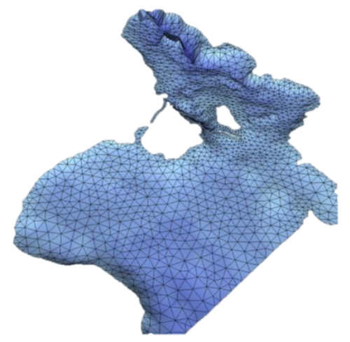
Smoothing a finite-element mesh can significantly improve the quality of a mesh that, in some cases, might be unsatisfactory after the generation process due to the presence of too many triangles with acute angles. Within groundwater modelling it is essential to keep hydraulic structures, e.g. well locations and other structures defined by the user at their original position. In FEFLOW 6.0, only a global mesh-smoothing option was available, which does not provide the means to exclude selected mesh nodes from shifting positions during the smoothing process.
With the upcoming version of FEFLOW 6.1, we have improved the smoothing functionality significantly: Smoothing can now be applied in selected areas of the finite-element mesh, only allowing maintaining the original positions of boundary conditions etc. as defined by the modeller.
WEST: How to convert plant layouts and experiments from older WEST versions?
The new WEST3 conversion tool allows for converting plant layouts and experiments from WEST 3.7.6 to WEST 2011. It will be available with the release 2012 and via download at the MIKE by DHI website.
Layouts that are based on the standard WEST model library are supported without further ado. During conversion, the user can choose whether to adopt the new WEST 2011 icons, or the old WEST 3.7.6 icons for the converted layout. The conversion tool does not require WEST 3.7.6 to be installed. However, it does require a valid WEST 2011 license.
Please do not hesitate to contact MIKE by DHI support if you have any questions related to WEST, or how to get the most out of the software.
MIKE URBAN: Storm Water Tools
With the release of MIKE URBAN 2012, the Storm Water Tools will be fully implemented into MIKE URBAN using either MOUSE or SWMM as simulation engine.
The MIKE URBAN Storm Water Tools focus on building the Storm Water model within a 1D framework. The tools supplement the standard MIKE URBAN installation by empowering the user with the ability to carry out:
- Lateral snapping of digitised rivers to the lowest point in DEM
- Cross section extractions from DEM
- Auto connections of overland network to sewer network
- Sequential labelling of nodes
- Catchment slope and length calculations
Highlights from The Network (March 2012)
The latest MIKE by DHI NetWork newsletter has been published, and a selected article is presented below: -
Application Examples
The newsletter can be viewed online here.
- Protecting clean drinking water from Lake Ontario, Canada:
Most of the North American region and in particular Ontario’s 13 million residents are highly dependent on clean drinking water from one of the Great Lakes. Thus, as contamination of the lakes could have severe consequences for many communities, a study was initiated to investigate potential threats to the water quality of Lake Ontario.
As a part of Ontario’s Source Water Protection program, a group called the Lake Ontario Collaborative was formed to study the potential threats to the drinking water. They have investigated potential impacts that activities on land, such as potential spills from surrounding waste water treatment plants, nuclear power plants, petroleum pipelines, and industrial facilities could have on the contamination of the water quality at the areas of intakes. For this purpose, they used an events-based approach, where potential spills were modelled by calculating the hydrodynamics as well as different aspects of the water quality. By using a full three dimensional illustration of water motion, including thermodynamics, it was possible to make accurate simulations and predictions of water currents in the lake and simulate the potential damage of a spill scenario.
As a result, they were able to develop intake protection zones. The zones were used to help raise awareness of the potential environmental and health risks that potential spills could entail as well as guide the preparation of emergency response planning in the event of a spill in the future. Want to read more? Click here.
To subscribe to the newsletter(s), please visit http://www.graphicmail.com/rwcode/subscribe.aspx?SiteID=3526&Mode=subscribe
Wednesday, 15 February 2012
Previews of MIKE by DHI 2012 Release
In the coming issues of our MIKE by DHI NetWork newsletter, we would like to disclose some previews of the new MIKE by DHI software package 2012, which is scheduled to be released this summer. The release will contain various new and exciting features, which we hope will improve your experience when using the software products, both with regard to usability, productivity, and enhanced applications.
Improvements for MIKE Animator in development
In 2012, MIKE Animator is to be replaced with MIKE Animator Plus. Compared to the existing MIKE Animator the new MIKE Animator Plus will offer an extended set of features. The most important of these new scheduled features are be:
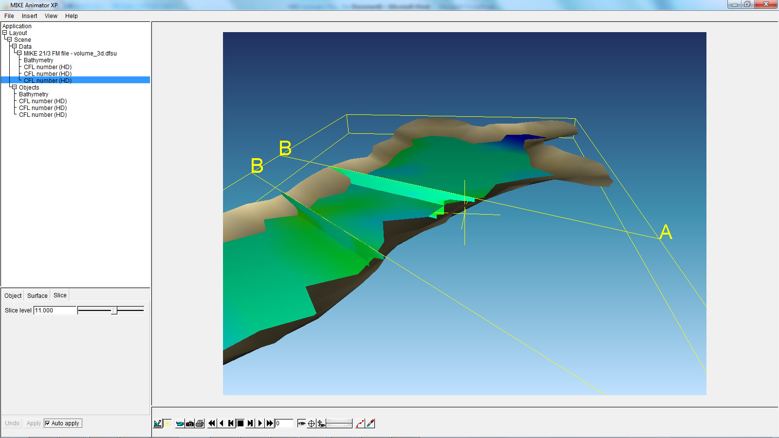
The above example shows a MIKE 3 Flexible Mesh result file with two vertical and one horizontal slice. This new feature will allow the user to get a much better overview of large 3-dimensional result files than ever before.
Littoral Processes FM: Re-design and development of LITPACK
In version 2011, the first step of the re-design of LITPACK was released, including the modules LITSTP and LITDRIFT. In the scheduled release for 2012, this re-design continues and includes the functionalities included in LITLINE.
The redesign constitutes an important milestone in the development of the system with regard to improved usability and integration into the coupled FM modelling system. The most obvious changes include the new user interface, which have the same look and feel as the rest of the MIKE Zero based products, including MIKE 21. Also the file formats have been changed. There will be one common set-up (pfs) file for all LITPACK-modules and the consequent use of standardised dfs-file formats has made it possible to introduce a higher flexibility when defining input- and output data. In this sense, one of the improvements included in the release in 2012 is the ability to work with an unlimited number of wave climates along the coastline, defined in a dfs1-file. Furthermore, all data in Littoral Processes FM will be geo-referenced, something which also makes it possible to display data in a graphic, geo-referenced view.
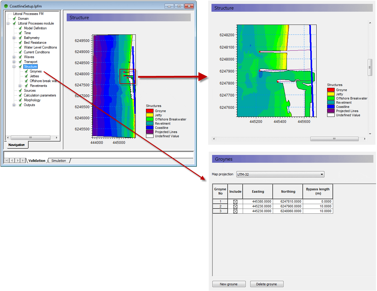
The above example shows the geographic positioning of groyne structures, with a mesh file shown as background.
Behind the scenes of MIKE URBAN 2012
Also MIKE URBAN users will notice improvements in 2012, where the new MIKE URBAN will transform the way people use hydraulic software. Be more productive and take advantage of the new, scheduled processing features of MIKE URBAN.
Currently our developers work hard to implement calibration plots and reports inside MIKE URBAN. This functionality will support plots of measured and simulated data. MIKE URBAN users will benefit from the possibility to generate series of calibration plots showing corresponding values of measured and simulated data along with comparison statistics in a tabular form. Find out more about other features of MIKE URBAN in one of our next newsletters.
In the coming issues of our MIKE by DHI NetWork newsletter, we would like to disclose some previews of the new MIKE by DHI software package 2012, which is scheduled to be released this summer. The release will contain various new and exciting features, which we hope will improve your experience when using the software products, both with regard to usability, productivity, and enhanced applications.
Improvements for MIKE Animator in development
In 2012, MIKE Animator is to be replaced with MIKE Animator Plus. Compared to the existing MIKE Animator the new MIKE Animator Plus will offer an extended set of features. The most important of these new scheduled features are be:
- Support for MIKE 3 Flexible Mesh result files - including vertical and horizontal slices, sigma layered slices and isosurfaces.
- Support for MIKE 3 Classic result files - including vertical and horizontal slices, sigma layered slices and isosurfaces.
- Extended image draping – meaning that multiple geo-referenced images can be rectified online and draped onto selected surfaces
- Import of solids – solids can be buildings, dams or other types of structures.
The above example shows a MIKE 3 Flexible Mesh result file with two vertical and one horizontal slice. This new feature will allow the user to get a much better overview of large 3-dimensional result files than ever before.
Littoral Processes FM: Re-design and development of LITPACK
In version 2011, the first step of the re-design of LITPACK was released, including the modules LITSTP and LITDRIFT. In the scheduled release for 2012, this re-design continues and includes the functionalities included in LITLINE.
The redesign constitutes an important milestone in the development of the system with regard to improved usability and integration into the coupled FM modelling system. The most obvious changes include the new user interface, which have the same look and feel as the rest of the MIKE Zero based products, including MIKE 21. Also the file formats have been changed. There will be one common set-up (pfs) file for all LITPACK-modules and the consequent use of standardised dfs-file formats has made it possible to introduce a higher flexibility when defining input- and output data. In this sense, one of the improvements included in the release in 2012 is the ability to work with an unlimited number of wave climates along the coastline, defined in a dfs1-file. Furthermore, all data in Littoral Processes FM will be geo-referenced, something which also makes it possible to display data in a graphic, geo-referenced view.
The above example shows the geographic positioning of groyne structures, with a mesh file shown as background.
Behind the scenes of MIKE URBAN 2012
Also MIKE URBAN users will notice improvements in 2012, where the new MIKE URBAN will transform the way people use hydraulic software. Be more productive and take advantage of the new, scheduled processing features of MIKE URBAN.
Currently our developers work hard to implement calibration plots and reports inside MIKE URBAN. This functionality will support plots of measured and simulated data. MIKE URBAN users will benefit from the possibility to generate series of calibration plots showing corresponding values of measured and simulated data along with comparison statistics in a tabular form. Find out more about other features of MIKE URBAN in one of our next newsletters.
The latest MIKE by DHI NetWork newsletter has been published, and selected articles are presented below: -
Product News
- MIKE by DHI ISO 9001 certification: We are proud to announce that DNV has granted DHI the official "ISO 9001: Quality Management Systems" certificate. "Consistent, high quality of not only our software development processes but of the entire user experience with the MIKE products is our single highest priority" says Jørgen Bo Nielsen, Managing Director of the MIKE by DHI global business. Click here to read more about the ISO 9001 certification or click here to read more about it in our latest newsletter.
- MIKE by DHI in the CLOUD: Meet your deadlines without buying more hardware or software. You can now get easy access to more licenses and more hardware through the new MIKE by DHI Software as a Service (SaaS) Portal. Get started with MIKE in the cloud now! Click here to go to the MIKE by DHI SaaS Portal or click here to read more in our latest newsletter.
- Study in Florida accomplishes reduction in dredging frequency: The Matanzas Inlet in Florida and an Intracoastal Waterway close to the inlet were challenged with high waves and high levels of shoaling. This was due to a close proximity to a natural sandy inlet, causing sediment transport into the Intracoastal Waterway. The challenge of high maintenance requirements of the Matanzas Inlet in Florida has caused the Florida Inland Navigation District to initiate a study to investigate the inlet area and examine alternatives to reduce the sediment inflow into the waterways. The study was performed by Taylor engineering and a coastal model was developed using MIKE21. With concerns to the estimated construction and maintenance cost, a deep sediment basin was chosen, from several alternative solutions, which would reduce dredging frequency in the Intracoastal Waterway to one dredging operation every four years as opposed to the previous average of 2.7 years. Read more here.
- Floating breakwater reduces wave heights in tugboat port in Germany: In one of the major ports, Jade Weser Port, in northern Germany the construction of a temporary tugboat port was challenged by high waves of up to 0.8 m for a mean water level of +3.00 m NN within the port. This was caused by an exposed location of the port affected by primarily eastern and northern winds. A study was conducted for client, Inros Lackner, in order to discover ways of reducing the impact of the winds within the port area using a MIKE 21 Boussinesq wave model (BW). The study determined the actual height of the waves and a simulation of the possible reduction was made. The reached solution became a floating breakwater within the port that would reduce the wave heights of about 10–30 pct. With the combination of expert consultancy and high quality software, they were able to reach a solution that was inexpensive, fairly easy to install, and with great result for the client. For more information, read here or please contact Oliver Stoschek or Anja Brüning.
- New insight into Bull Sharks' behaviour in Australia using individual-based modelling: Studying fish, sharks, and other marine mammals is often a challenge due to lack of accurate information that provides a realistic portrait of their living conditions, movements, and the elements that affect their behaviour. Researchers at Griffith University in Queensland in Australia have recently successfully employed an individual-based modelling technique to investigate the habitat and movement patterns of juvenile bull sharks in the Tallebudgera Creek estuary in Australia. The modelling tools in MIKE21 and ECO Lab were used to accurately capture the hydrodynamics of the estuary to create a virtual habitat and integrate tracking results of a number of juvenile bull sharks. Their work has provided new valuable knowledge and a fairly accurate picture of, which elements affect the bull sharks and their living conditions such as water quality, salinity levels, turbidity, and currents. Thus, this use of individual-based modelling paves the way for new possibilities of researching marine mammals in the future. The research project at Griffith University in Australia is a recent example of how MIKE by DHI supports universities by providing software to PHD and MSc students on very favourable conditions. For more information about individual-based modelling, please contact Michael Potthoff. For more information about the specific research on bull sharks, please contact Jonas Brandi Mortensen.
- Flood modelling enlighten community in Iowa, United States: In 2008, the state of Iowa in the United States experienced severe flooding, where many property owners and entire communities suffered. Since then, Iowa Flood Center (IFC) has used MIKE FLOOD modelling of the severe 2008 floods for community outreach and education. "The Iowa Flood Center (IFC), a state-funded center comprised of IIHR–Hydroscience & Engineering researchers, has been using MIKE FLOOD to simulate flood discharges in several Iowa communities. The simulations have been used to numerically reconstruct the severe 2008 Iowa floods and to develop libraries of static inundation maps relating river stage and discharge to flood extents and depths in each community. The intent is to provide communities and individuals an impression of how river stages and discharges forecasted at discrete points may affect their properties." Nathan C Young, Associate Director, Iowa Flood Center. Read more here. The maps are available on the IFC website as part of the Iowa Flood Information System (IFIS).
- Focused mitigation of hazardous urban discharges: Comprehensive monitoring and modelling of discharges of hazardous substances in the Copenhagen Harbour district revealed the most important point sources of selected substances and thereby allows for a sensible and target-oriented prioritisation of future mitigation measures. The present study determined whether or not specific point sources (e.g. wastewater treatment plants, industries or combined sewer overflow) release significant emissions of hazardous substances as listed in the Baltic Sea Action Plan. It was carried out within the framework of the EU-funded COHIBA-project (Control of Hazardous Substances in the Baltic Sea Region) as a combination of wastewater measurements, load estimations and modelling of the discharges (hydrodynamic marine fate modelling with MIKE 3 and ECOlab). Read more.
| Hydrodynamic fate modelling of Bisphenol A in Copenhagen Harbour. The animation shows the modelled discharge, spreading and fate of Bisphenol A after heavy rain, which results in combined sewer overflows. Moreover, industrial discharges are modelled. The model takes into account substance specific fate data (biodegradation, photolysis and hydrolysis) as well as adsorption to suspended solids. |
The newsletter can be viewed online here.
To subscribe to the newsletter(s), please visit http://www.graphicmail.com/rwcode/subscribe.aspx?SiteID=3526&Mode=subscribe
Wednesday, 18 January 2012
The latest MIKE by DHI NetWork newsletter has been published, and selected articles are presented below: -
Product News
- High Performance Computing: In the continuous efforts to enhance the value of the MIKE by DHI software, allowing our users to become more efficient, a High Performance Computing Center will assist in boosting the performance. DHI and the new High Performance Computing Center, IT4Innovations, have signed a collaboration agreement. The agreement covers the joint development of new features for the MIKE product family - aiming at making the power of the latest HPC technology available to MIKE software users. Read more here.
- MIKE FLOOD de facto standard in Italy: Implementation of the EU Floods Directive call for enhanced use of deterministic models for risk assessment and management of floods. In Italy MIKE FLOOD is already a standard in many Italian regions, and has officially been adopted by many River Basin Authorities. Some of these authorities have organised training courses in MIKE FLOOD with participants from other sister organisations. MIKE FLOOD is now the most frequently used 2D numerical model in Italy. Read more here.
- Tsunami Hazard Assessment and Emergency Response Planning (MIKE 21): Port of Long Beach, CA and Port of Los Angeles, CA use Advanced Wave Modelling for Tsunami Hazard Assessment and Emergency Response Planning. Interest in assessment of the potential for tsunamis along the southern California coast and the associated impacts to the Ports of Los Angeles and Long Beach was renewed in light of the devastation caused by the recent Indian Ocean earthquake and tsunami of December 26, 2004. Historically, concern for tsunamis along the California coast has been limited to distant sources such as Alaska, Chile, or others. However, a few recent studies have been suggesting potential tsunami sources within the southern California Bight which could have a greater impact to the Ports due to the short travel distance and higher amplitudes than expected from the remote sources. Moffatt & Nichol conducted an investigation of the potential tsunami hazard for the Ports of Long Beach and Los Angeles. A detailed tsunami propagation and inundation numerical model was prepared using DHI's MIKE 21 Boussinesq Wave Model to evaluate several potential sources of a tsunami, including potential subaquatic landslides, a thrust fault, and several strike slip faults capable of producing seafloor uplift. Click here to read the full article. An animation can be seen below.
- Addressing Stormwater Drainage Problem (MIKE URBAN): City of Newport Is Addressing Stormwater Drainage Problems using 2D Urban Flood Modelling The City of Newport News has been working in cooperation with the Hampton Roads Sanitation District (HRSD) to develop and calibrate a hydraulic model of the City's wastewater collection system using DHI's MIKE URBAN software. The City's model is being used in conjunction with a regional hydraulic model being prepared by HRSD to evaluate and optimize a wet weather control plan. Building on the success of this program, the City has decided to leverage their investment in MIKE URBAN by also using it for planning and design of the stormwater drainage and collection system. Click here to read the full article.
- Evaluation of Environmental impacts from cooling water system (MIKE 3): Click here to read the full article.
- Wastewater Treatments Plant applications (WEST): Want to read more? Click here.
- Optimizing Wastewater Facility Plan (MIKE URBAN): Click here to read the full article.
Other News
Additional Case Studies
- Put your mind at ease, DHI makes sure you have a clean and relaxing swim! Three of our Danish experts, Anders Erichsen, Hanne Kaas and Claus Jørgensen, highlight dynamic modelling of bathing water quality for early contamination warning in the December newsletter of the WHO Collaborating Centre for Health Promoting, University of Bonn. Read their article here.
- Getting the most out of hydropower potential in the Alps! DHI has joined the Enermet consortium and will provide accurate forecasts of the hydropower potential in selected countries of the Alps, thereby adding key information to the existing weather and energy forecasts. The system is based on a methodology that has previously been developed by DHI for the Scandinavian countries. Read more here.
To subscribe to the newsletter(s), please visit http://www.graphicmail.com/rwcode/subscribe.aspx?SiteID=3526&Mode=subscribe
.
Tuesday, 25 October 2011
The latest MIKE by DHI NetWork newsletter has been published, and contains the following articles: -
Main Article
Product News
- MIKE by DHI 2011 Service Pack 6
Application Examples
- Improving bypass and increasing navigation depth
- Improving system optimization for wastewater utility
- Improving preventive flood protection
- What the users say
- Feed-back from UGMs, Conferences and Seminars in 2011
- Upcoming Events
- Training
- Feedback from training courses in 2011
- Upcoming MIKE by DHI Training Courses
Update - Revamped Publications Section & DHI Scribd channel
Please visit our revamped Publications section here. We’ve enriched the content with lots of useful material such as case stories and solution flyers – which are now accessible through our new Scribd Channel.
Follow us on our new DHI Scribd channel, to easily access and share our publications. Scribd, the world's largest social reading and publishing site, ensures widespread access to our documents and offers easy sharing functionalities.
Click here
Other News

To subscribe to the newsletter(s), please visit http://www.graphicmail.com/rwcode/subscribe.aspx?SiteID=3526&Mode=subscribe
.
Subscribe to:
Posts
(Atom)
Follow DHI...


