Thursday 20 December 2012
Wishing you all a very happy Christmas and a peaceful New Year

We are looking forward to welcoming you to our Spring 2013 User Group Meeting on the 19th March 2013, and Seminar Day on 20th March 2013, at the Lion Quays Waterside Resort, Oswestry, UK.
The User Group Meeting will include a mixture of presentations of new software features and technologies, as well as practical case studies and papers presented by UK users. Participation in the User Group Meeting, and the Training Seminars, is free of charge.
If you would like to present a paper at the User Group Meeting, please contact Simon Matthews on 01694 722795 / sm@dhigroup.com or Steve Flood on 01752 691723 / sjf@dhigroup.com for more information.
For the Seminar Day, we would welcome suggestions for training content. For inspiration please see our latest DHI-UK Training Course Schedule here and the MIKE by DHI Software catalogue here.
Online booking will be available shortly, and you will soon receive an e-mail with the link.
The DHI UK Team
Topography Adjustment Tool for MIKE 21 / MIKE FLOOD (A MIKE by DHI Software Custom User Tool)
 The Topography Adjustment Tool is a MIKE by DHI Software Custom User Tool developed for the purpose of automating the process of using polygon shape files to adjust topography values in dfs2 files used in MIKE 21 surface water flow models. The main application of the tool is to use a polygon shape file of buildings to automatically assign land values to the dfs2 grid cells which are intersecting the building polygons. However, the tool has been designed such that it can also be used to ‘burn’ roadways into the dfs2 topography. In fact, although the tool is primarily intended for adjusting topography, it can be used to adjust any .DFS2 file using a polygon shape file to select the grid cells of interest.
NB: The Topography Adjustment Tool is provided ‘as is’ and is not part of the commercially distributed MIKE by DHI software products. As such, it is not a supported software product and technical support is not available. Additionally, the Topography Adjustment Tool was developed to work with the 2012 Release format of .DFS2 files but it is expected it will work with some earlier versions of dfs2 files and will continue to work for future releases as long as major changes are not made to the structure and content of .DFS2 files.
NB: The Topography Adjustment Tool is provided ‘as is’ and is not part of the commercially distributed MIKE by DHI software products. As such, it is not a supported software product and technical support is not available. Additionally, the Topography Adjustment Tool was developed to work with the 2012 Release format of .DFS2 files but it is expected it will work with some earlier versions of dfs2 files and will continue to work for future releases as long as major changes are not made to the structure and content of .DFS2 files.
Wednesday 19 December 2012
Introducing MIKE LICENSING FLEX ACCESS
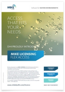 We are proud to introduce our new MIKE LICENSING-FLEX ACCESS policy with distinct advantages for present and new users, small businesses as well as large corporations and universities.
As an organisation with many modellers working in teams, perhaps across organisational, regional or even national borders, you will enjoy the complete freedom that comes with our CORPORATE licences – and the attractive prices of additional seats as well as on support.
Larger or smaller organisations working on time limited projects may choose the SUBSCRIPTION licence due to its combination of flexibility and limited investment.
And organisations working on a limited project budget will find that they can get access to the full power of the MIKE software for a single user through the PERSONAL licence.
With our new MIKE LICENSING-FLEX ACCESS policy there is a licence for all possible needs – at the right price.
Check out this web page for more information: -
UK users with current MIKE by DHI licences have received informational letters, and will be contacted by the UK Team soon who will explain the changes to their licences. To find out more in the meantime, please contact Steve Flood on 01752 691723.
Subscribe to:
Posts
(Atom)
Follow DHI...


