Sunday 9 September 2012
Previews of MIKE by DHI Release 2012

We are gradually approaching the release of the MIKE by DHI software package 2012, which is scheduled for this October. As in previous issues of our newsletter, we would like to disclose a preview of the many new and exciting features, which we hope will improve your experience when using the software products, both with regard to usability, productivity, and enhanced applications.

MIKE 21: Earthquake bathymetry adjustment tool

In version 2012, a new tool that can assist undertaking of Tsunami-simulations is introduced: earthquake bathymetry adjustment tool. For several years, it has been possible to work with time varying bathymetries (using the landslide option) in MIKE 21 Classic. The usability of this feature is now enhanced, as it will be easier to simulate tsunamis using the new tool. The earthquake bathymetry adjustment tool calculates sea bottom displacements that occur during an earthquake. The output is a time-varying bathymetry file, which can be used in MIKE 21 HD (classic) with the landslide option to generate wave propagation.

The method for calculation of the sea bottom displacements is an amplified version of the double-couple method developed by Okada (1985). The necessary input data for earthquakes can be retrieved from public databases. The tool is available in the MIKE 21 Toolbox in a new group called Seismology.

MIKE MARINE GIS will be discontinued

MIKE MARINE GIS will be discontinued and will not be available on the MIKE by DHI 2012 DVD. It has been evaluated that the user base for MIKE MARINE GIS was not sufficient to maintain the programme on the Esri platform. However, in version 2012, many of the tools that were previously available through MIKE MARINE GIS, have been transferred into MIKE Zero. Thus, we are enhancing the functionalities available for most users: -
  • Tools for creation of transects, profiles, baselines, and coastlines are included in the bathymetry editor
  • The MIKE Zero tool “Geo Referencing Image File” has been extended to read and convert Esri world format files to DHI world file format
  • The MIKE2SHP tool is extended to support mesh and dfsu files
MIKE URBAN: Advisor Tools for modelling water distribution networks

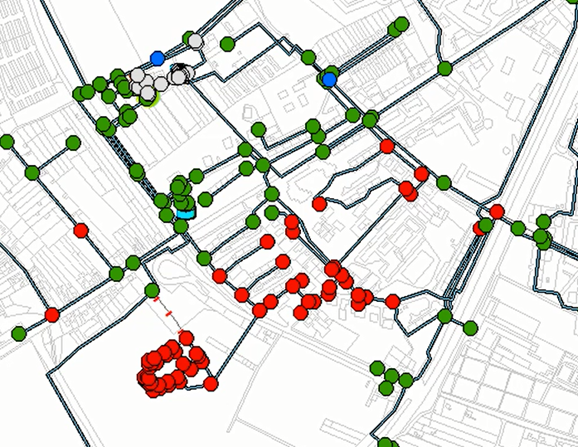
The costs of pipe failures in water distribution networks are increasing and are forcing operators and utility managers to develop strategies and solutions to identify and replace critical pipes. With the upcoming release of MIKE URBAN, a new set of advisor tools will be available to support these processes.

Pipe criticality modelling will predict how the water distribution system responds to: -
  • Pipe break situations
  • Planned reconstructions
  • Limited water supply
Sustainability analyses will help to understand simulation results and detect possible problems, anomalies, and critical areas in the network. In addition to the map layers, a detailed html report will be provided for the entire network as well as for particular zones: -
  • Storage tanks: reports tanks that are either drained or overflows during the simulation, reports if the tanks are balanced within the simulation
  • Pumps: reports pumps that are operated close to their maximum capacity
  • Unit head loss: reports pipes with too high unit head loss
  • Service pressure: reports excessive pressure that exceed the service criteria
  • Pipe flow: reports reverse flow in pipes
  • Flow velocity: reports excessive flow velocity
Furthermore, cost analyses allow for reviewing the energy consumption results in more details, creating tabular outputs and graphs of pump utilisation, average power consumption, and costs.
.

Labels

15th MIKE by DHI UK User Group Meeting (7) 16th MIKE by DHI UK User Group Meeting (18) 2014 MIKE by DHI UK Symposium (7) 2015 DHI UK and Ireland Symposium (2) 2015 DHI UK Symposium (2) 2015 MIKE by DHI UK Symposium (2) 2D modelling (1) 64-bit (1) ABM Lab (4) All-Energy (1) Aqua Republica (1) aquaculture (1) bathing water quality (4) Bird Collision (1) Blog Admin (1) Breach Assessment (2) Breach Modelling (3) Burrator Historic and Natural Environment Project (1) Burrator Reservoir (1) Catchment Management (3) catchment modelling (1) Catchment Systems (1) Central Modelling Platform (1) CIWEM (2) Cliff Recession (1) Climate Change (5) Climate Change Policy (1) Climate Change Scenario Modelling (1) Climate Change Tool (4) Cloud Computing (1) coastal erosion (1) coastal inundation (1) coastal modelling (2) Coastal Oceanography (1) Computer Aided River Management (1) Conferences (2) Contaminant Transport (1) CORFU (3) coupled groundwater and ecological models (1) coupled hydrology-hydraulic modelling (1) Coupled Models (2) CPU (1) cyclones (1) Dam break (3) data sharing (1) debris factor (1) Defra (1) DEMO (4) Devon (2) Dewatering (1) DHI (163) DHI UK & Ireland Symposium 2016 (1) Dike Structure (1) Download (1) Dredging (2) Dune Erosion (1) ECO Lab (10) Ecological modelling (5) Ecosystems (2) EIA (1) Environment Agency (2) Environmental Engineering (1) Environmental Management (1) EU Floods Directive (1) European Overtopping Manual (1) EuroTop (1) FD2320 (1) FD2321 (1) Feedback (1) FEFLOW (24) FEFLOW 2012 (3) FEFLOW 2015 (2) FEFLOW Essentials (2) FEFLOW User Conference (1) flash floods (1) Flexible mesh (7) Flood and Water Management Act 2010 (1) Flood Damage Assessment (2) Flood Defences (3) flood depth (1) Flood Forecasting (6) Flood Impact Assessment (1) Flood Modelling (10) Flood Resilience (3) Flood Risk (6) Flood Risk Assessment (5) flood risk management (1) Flood Risk Management (Scotland) Act 2009 (1) Flood Risk Regulations 2009 (1) Flood Risks to People (1) flood warning (1) flood warning systems (1) Flooding (15) Floodplains (1) Fluid mechanics (1) forecasting (3) Forum (1) FRA (1) games (1) Geothermal energy (1) GIS (1) Global Tide Model (1) Google Earth (1) GPU (3) Ground Source Energy (3) Groundwater (12) Groundwater Modellers Forum (4) Groundwater Modelling (5) Guidance (4) Hazard Mapping (4) Hazard Rating (1) High Performance Computing (1) Hotfixes (1) HPC (1) hydraulics (2) ICE (2) ice flooding 2013 (3) ICE Flooding 2014 (1) ICFR (2) Integrated 1D-2D pollutant transport modelling (1) Integrated Catchment Management (8) Integrated Catchment Modelling (3) integrated modelling (5) Integrated Surface and Groundwater (9) Integrated Water Management (5) Interactive Game (1) International Conference on Flood Resilience (2) Ivybridge (1) land use changes (1) Licensing (1) Linux (1) LITPACK (4) Managed Aquifer Recharge (1) Manning's n (1) MAR (1) Marine Monitoring (1) Marine Renewable Energy (8) marine water quality (1) Maritime Archaeological Modelling (1) MIKE 11 (12) MIKE 21 (44) MIKE 21 BW (3) MIKE 21 FM (14) MIKE 21 FMHD (1) MIKE 21 FMPT (1) MIKE 21 OS (1) MIKE 21 ST (1) MIKE 21 SW (9) MIKE 21C (1) MIKE 3 (14) MIKE 3 FMPT (1) MIKE Animator (3) MIKE Animator Plus (2) MIKE BASIN (3) MIKE by DHI (173) MIKE by DHI 2014 (11) MIKE by DHI 2016 (2) MIKE by DHI UK Symposium (1) MIKE CUSTOMISED by DHI (33) MIKE FLOOD (32) MIKE FLOOD AD (2) MIKE HYDRO (1) MIKE HYDRO Basin (3) MIKE Powered by DHI (4) MIKE SDK (1) MIKE SHE (10) MIKE software (1) MIKE to Google Earth (1) MIKE URBAN (13) MIKE Zero (1) Mine Workings (2) Miniature Sensors (1) Mining (2) Mooring Forces (1) Morphological Change (2) NAM (1) News (15) Newsletter (10) Numerical modelling (1) Offshore Wind Farms (4) Oil Spill (1) Oil Spill Modelling (4) overtopping (3) Papers (1) parallelisation techniques (1) Particle Tracking (1) Planform Change (1) Plymouth University Marine Building (1) Porous Media (1) PREPARED (1) Presentations (1) productivity tools (2) Professor Kathrine Richardson (1) Queen’s University Belfast (3) rainfall data (1) rainfall dependent infiltration (1) rainfall radar (4) RDI (1) Real time control (5) Real-time (9) real-time control (1) real-time forecasts (7) Release 2011 (8) Release 2012 (13) Release 2014 (7) Release 2016 (1) Renewable energy (12) Research (1) Reservoir Inundation Modelling (1) River Modelling (4) River Monitoring (2) river restoration (1) Roughness (1) Rural Land Management Change (3) SaaS (1) Scour (2) scour risk (1) Sediment Transport (4) Serious Games (1) Service Packs (9) Sewerage (1) Shellfish Waters Directive (1) shellfisheries (1) shoreline evolution (1) slow response runoff modelling (1) Software (7) Software as a Service (1) Software Development Kit (1) Software Updates (9) South West Lakes Trust (1) SP2 (1) Spectral Wave (1) Spillway (1) Stakeholders (1) Steve Flood (1) storm surges (2) Storm Swell (1) storm water management (1) Structures (1) SuperGen UK Centre for Marine Energy Research (1) Support (9) Surface Water Flooding (4) Surface Water Management (3) Teaching (2) THE ACADEMY by DHI (42) The Catchment Approach (2) Thermal Plume Modelling (2) three-dimensional hydrodynamics (1) Tidal and storm surge water levels (1) Tidal currents (1) Tidal Energy (6) Tidal Push (1) Tides (3) Tips (4) Training (32) Treatment (1) tsunamis (1) Turbines (1) UGM (39) UK Christmas Party 2014 (1) UKCMER (1) University (2) University of Southampton (1) Urban Drainage (8) Urban Flooding (13) urban hydrology (6) User Group Meeting (36) User Group Meeting 2013 (7) User Group Meeting 2014 (10) User Group Meeting 2015 (2) Vegetation growth (1) velocity of flood waters (1) Vessel Motion (1) Wastewater (4) Wastewater Treatment Plant (2) Water Allocation (1) Water Distribution (1) Water Framework Directive (4) Water Quality (4) water quality modelling (4) Wave Energy (5) Wave Overtopping (5) Waves (6) weather radar (1) WEST (4) Wetland Restoration (1) WFD (3) wind turbine foundations (1) Workshop (1) WWTP (4) Yelverton (1)

Welcome to DHI UK

DHI is an independent, international consulting and research organisation with the global objective of advancing technological development and competence with respect to water, in all of its environments.

Worldwide, we offer a wide range of consulting services and leading edge technologies, software tools, environmental laboratories, and physical model test facilities, as well as field surveys and monitoring programmes. Designated as a not-for-profit organisation, DHI is able to invest a considerable portion of its resources in research and development. Today we co-operate with many Universities, and research organisations, and are recognised globally for our innovation and expertise.

In the UK, DHI offers niche or specialist consultancy services in the water and environment market to government agencies, commercial entities and selected research organisations. We fulfil a research based specialist advisor role; a ‘Consultant to the Consultants’. We also supply and support the renowned MIKE by DHI suite of integrated water modelling tools.

MIKE by DHI software is the result of years of experience and dedicated development and has, in many regions, become the standard modelling tool. It transforms our science into practice and gives you the competitive edge and, through the DHI Academy, you can rest assured that there is a local team of highly skilled experts committed to train and support you every step of the way.

MIKE by DHI truly models the world of water - from mountain streams to the ocean and from drinking water to treatment plant and beyond.

DHI Profile Video

Follow DHI...

Follow DHI on Facebook   Follow DHI on Twitter   Follow DHI on YouTube